
A Private Resort on Three Levels: Custom Pool and Outdoor Living Design in Peters Township
UNDERSTANDING THE VISION BEHIND THE PROJECT
Most backyards give you one level to work with. This one gave us three, and not by choice.
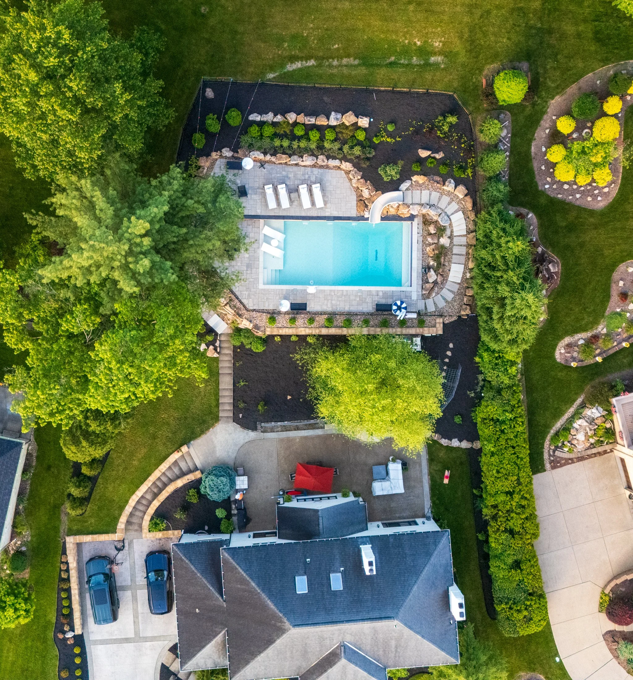
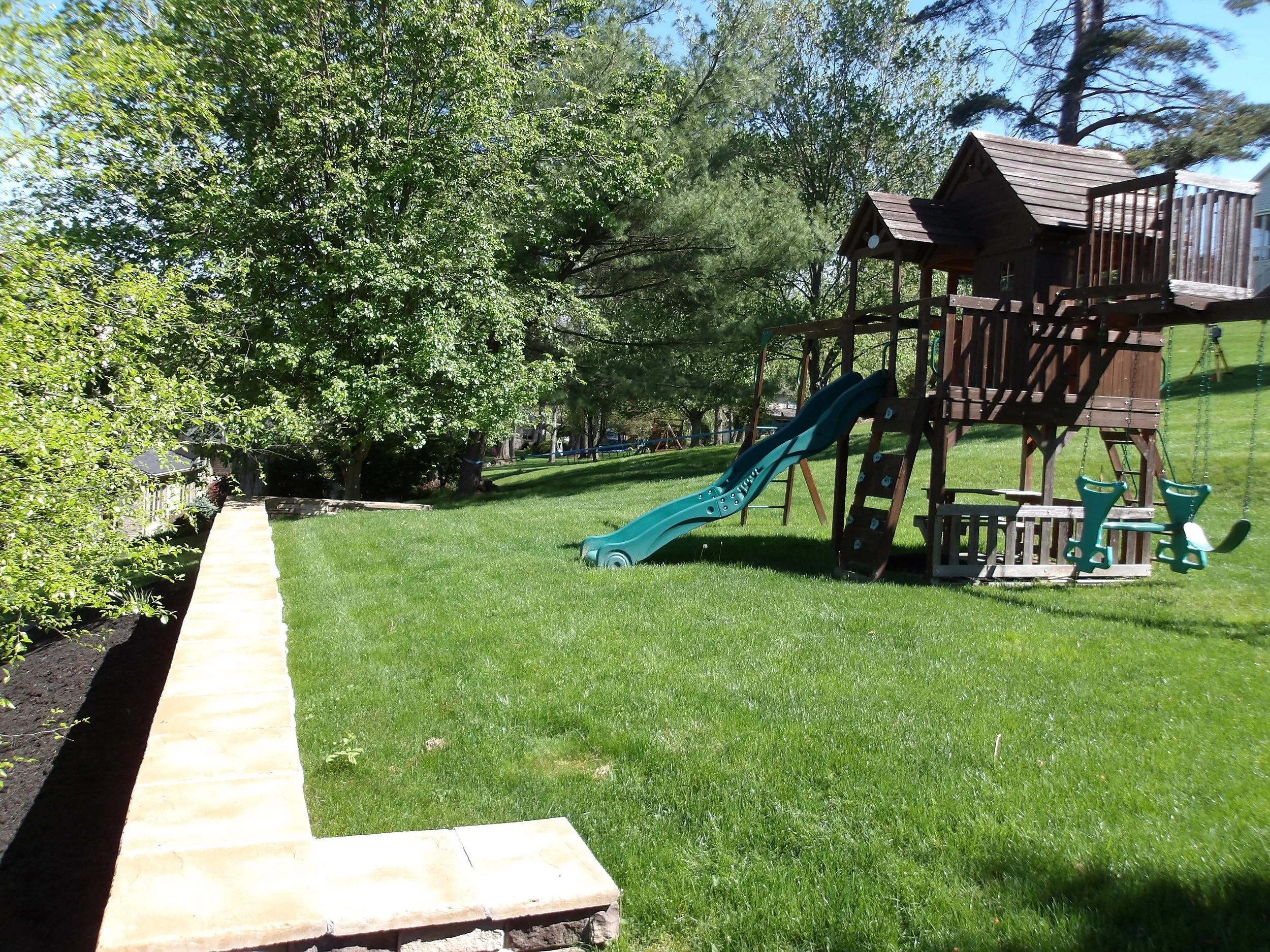
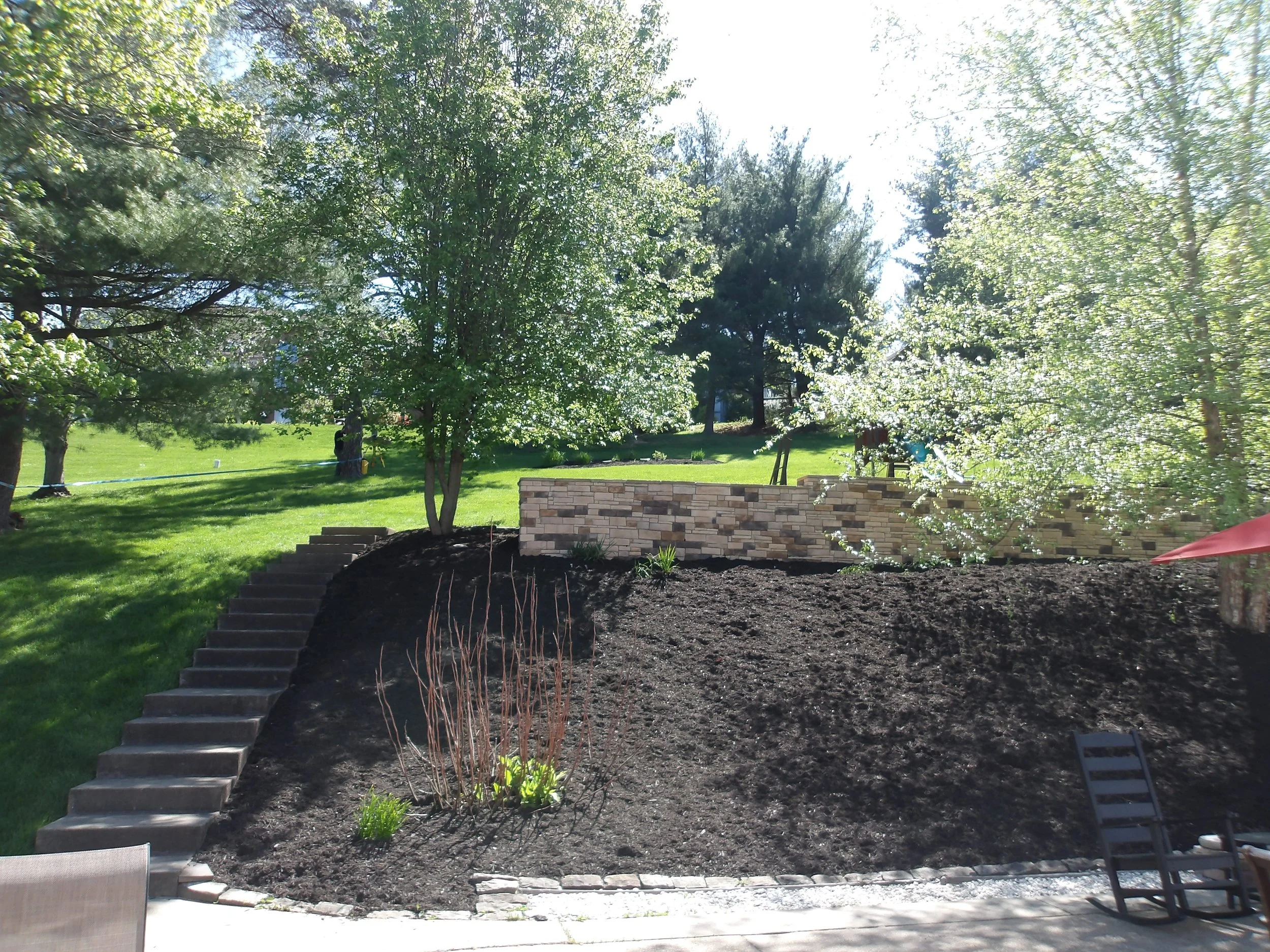
The property sits in Peters Township, on ground that steps up and away from the house. There was a patio at the back door, and then the land climbed, which is a pleasant thing to look at and a difficult thing to build on. A pool needs a flat plane. The site did not have one. Making one meant deciding where the flat plane would go, what would hold the earth back once it existed, and where the water would go afterward, because water on a slope always goes somewhere.
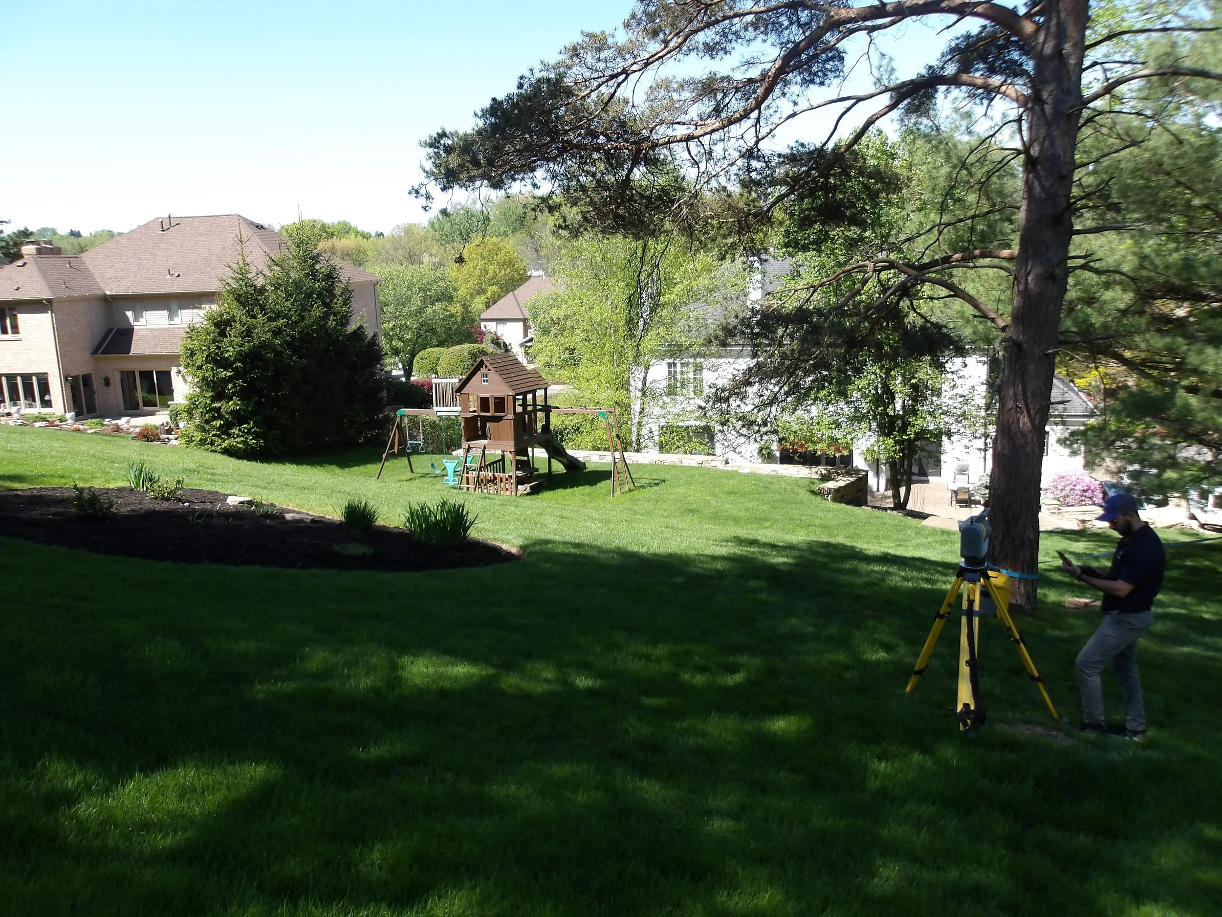
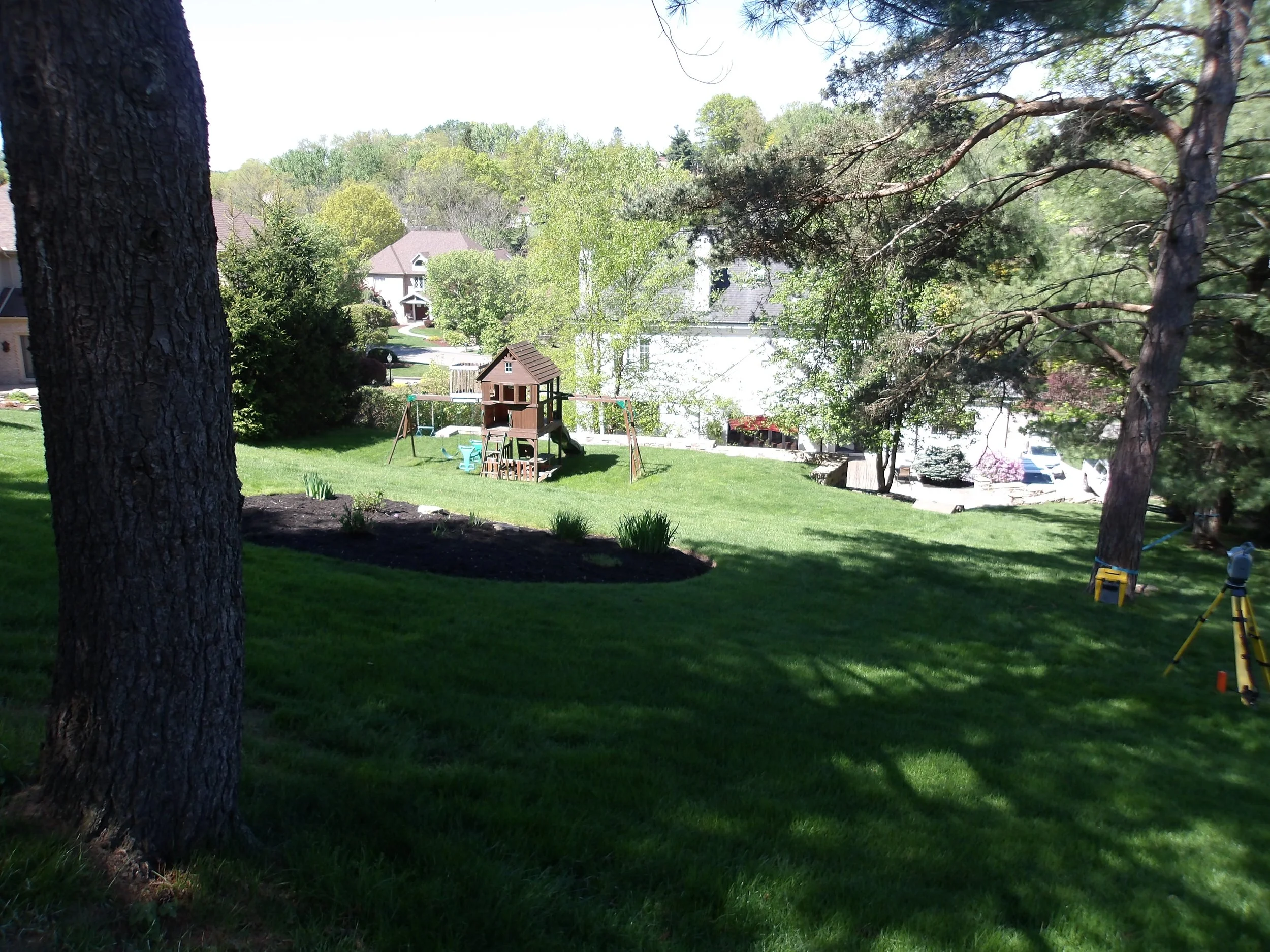
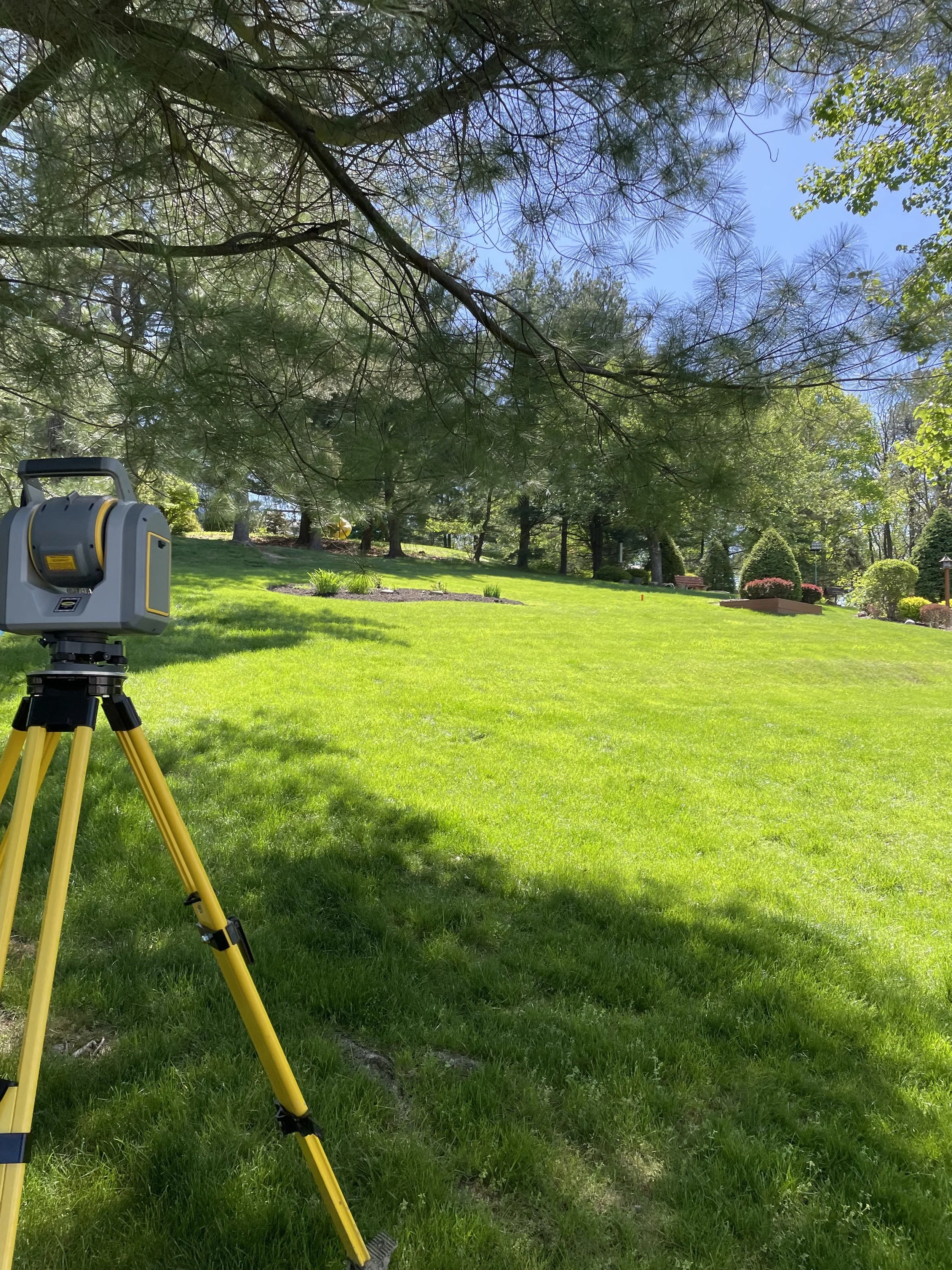
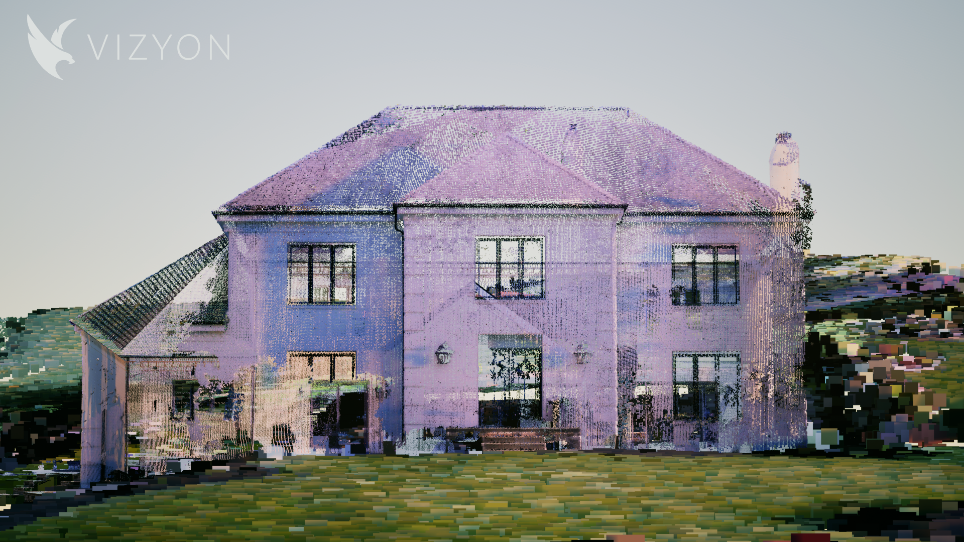
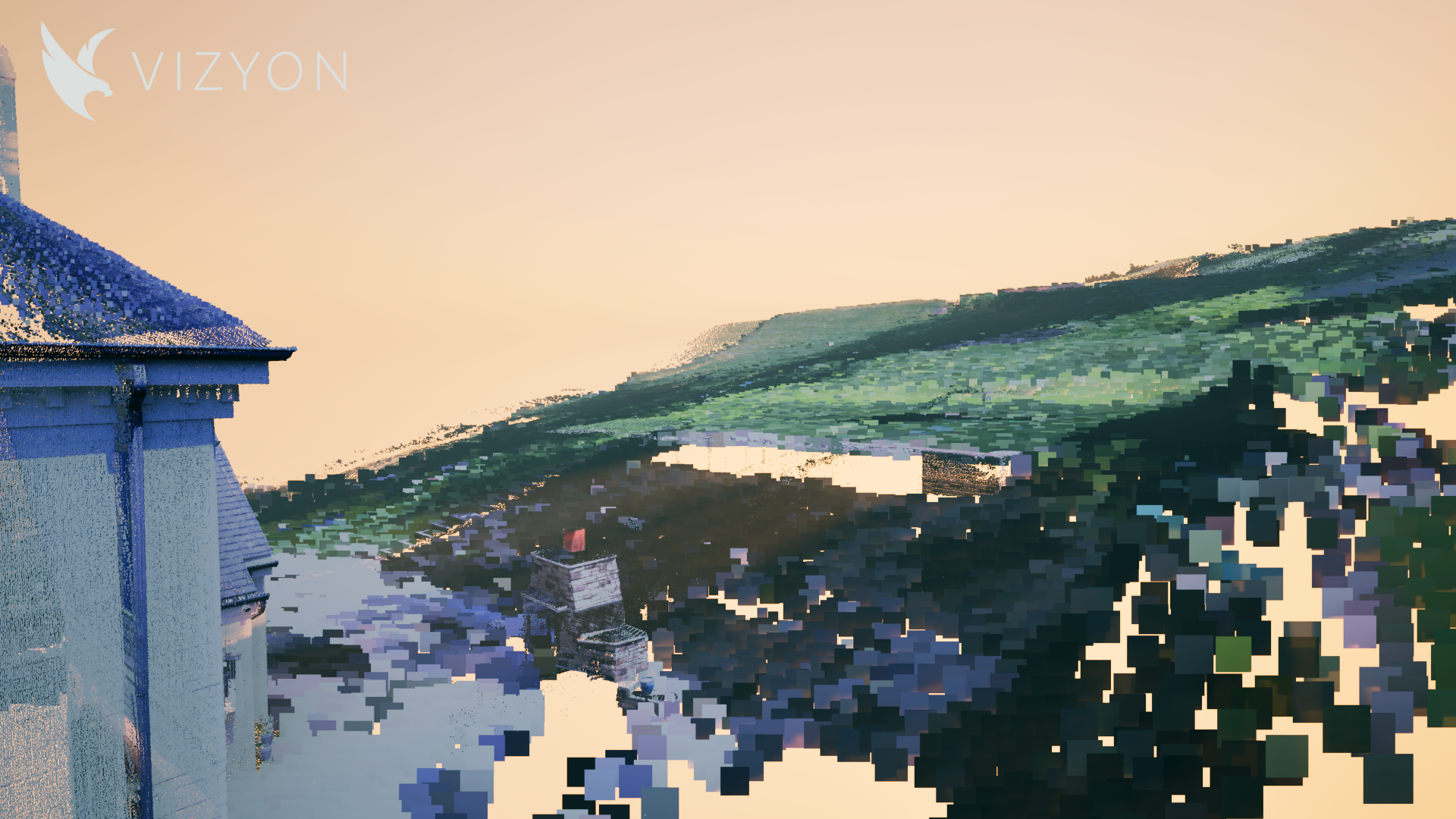
Vizyon Design Group scanning property with LiDAR Scanner
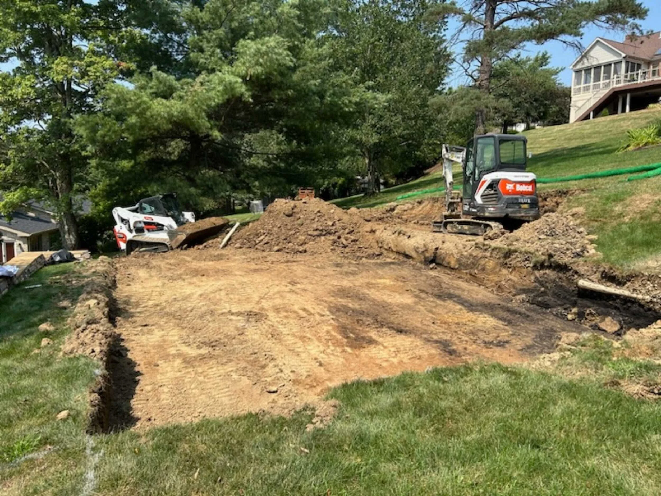
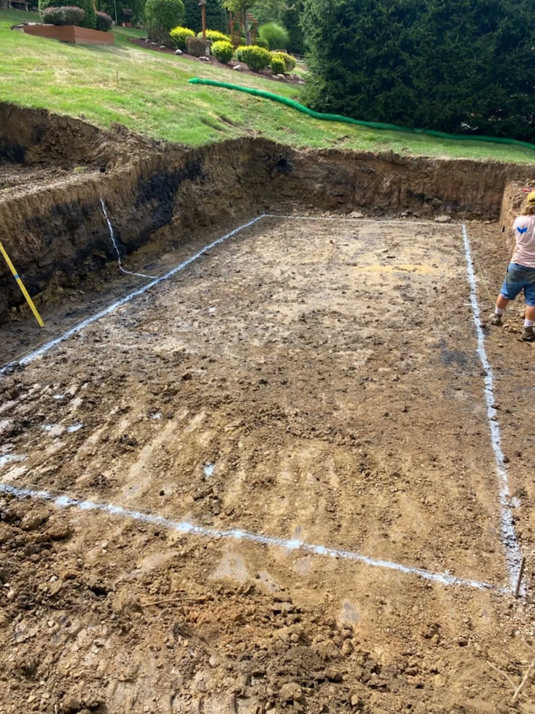
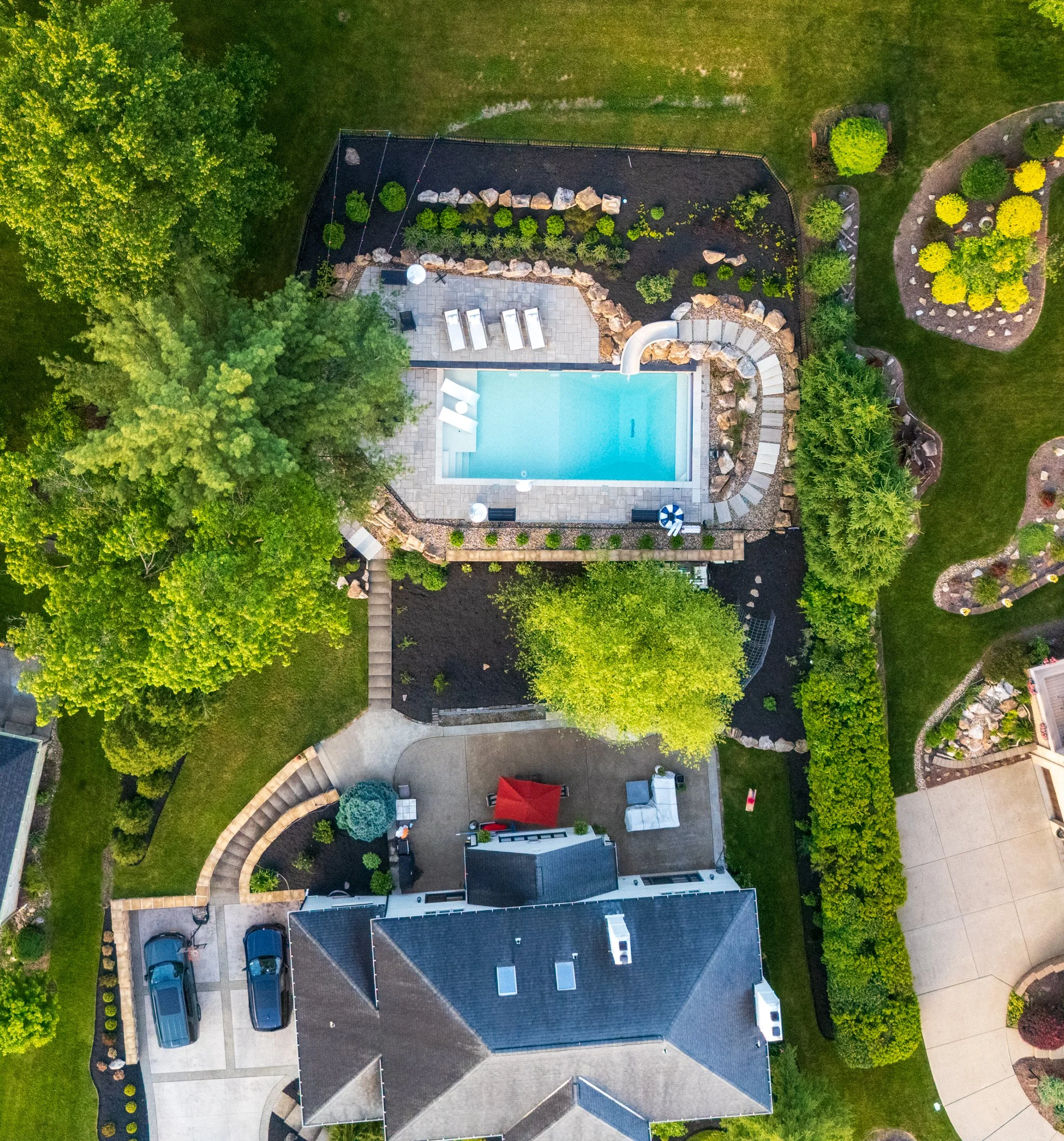
The family wanted a pool, a real patio to gather on, and a slide. Ordinary asks. What made the project interesting was that satisfying them required carving a terrace out of the hill, building a wall to hold that terrace in place, tiering boulders above it to retain the earth, and threading a drainage system through it so that the first heavy spring rain did not undo the work.
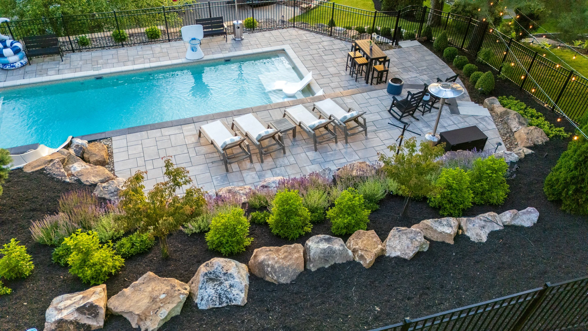
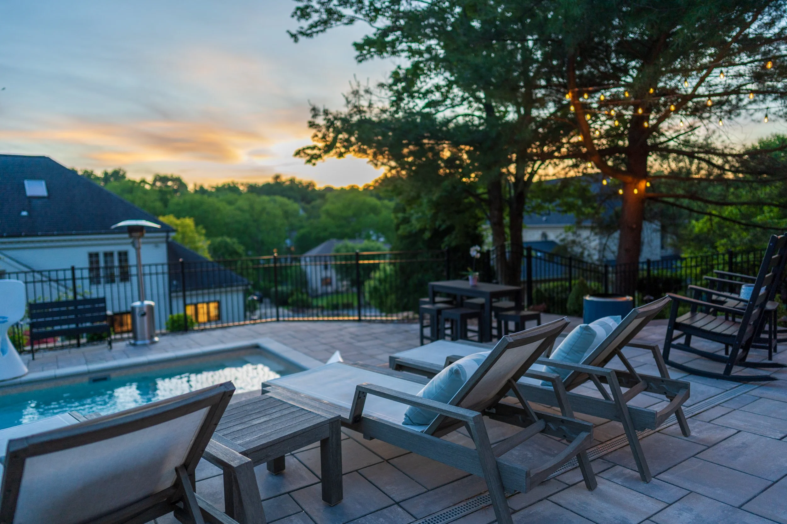
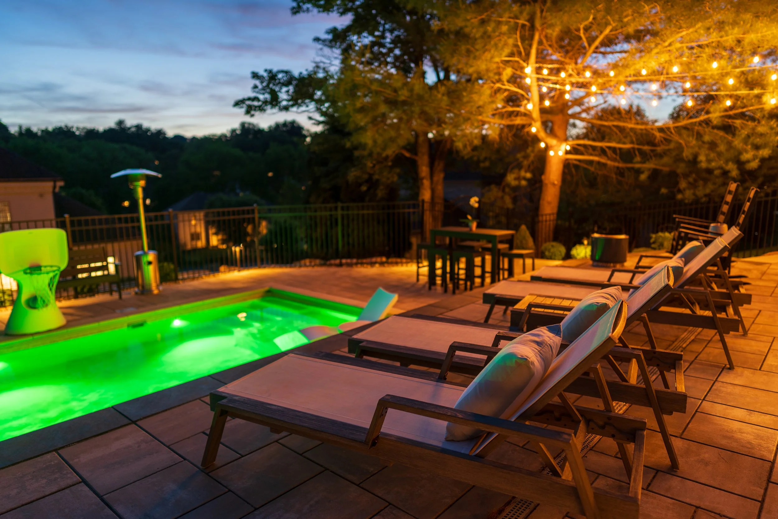
The finished space reads as though the yard was always shaped this way. That is the point. A backyard resort should not look like it won an argument with the land. It should look like the land was always going to do this.
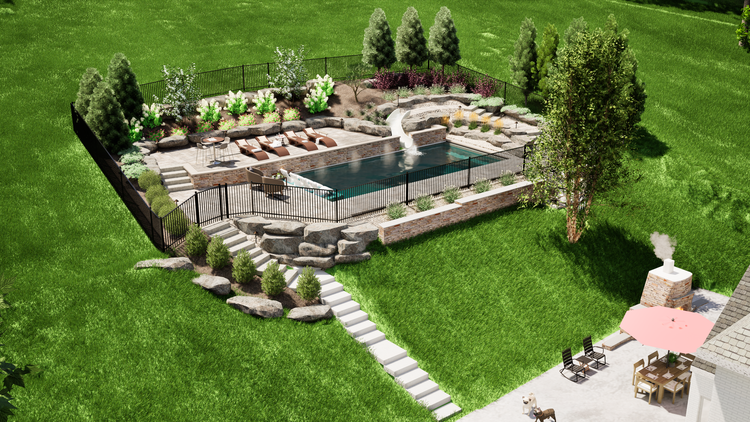
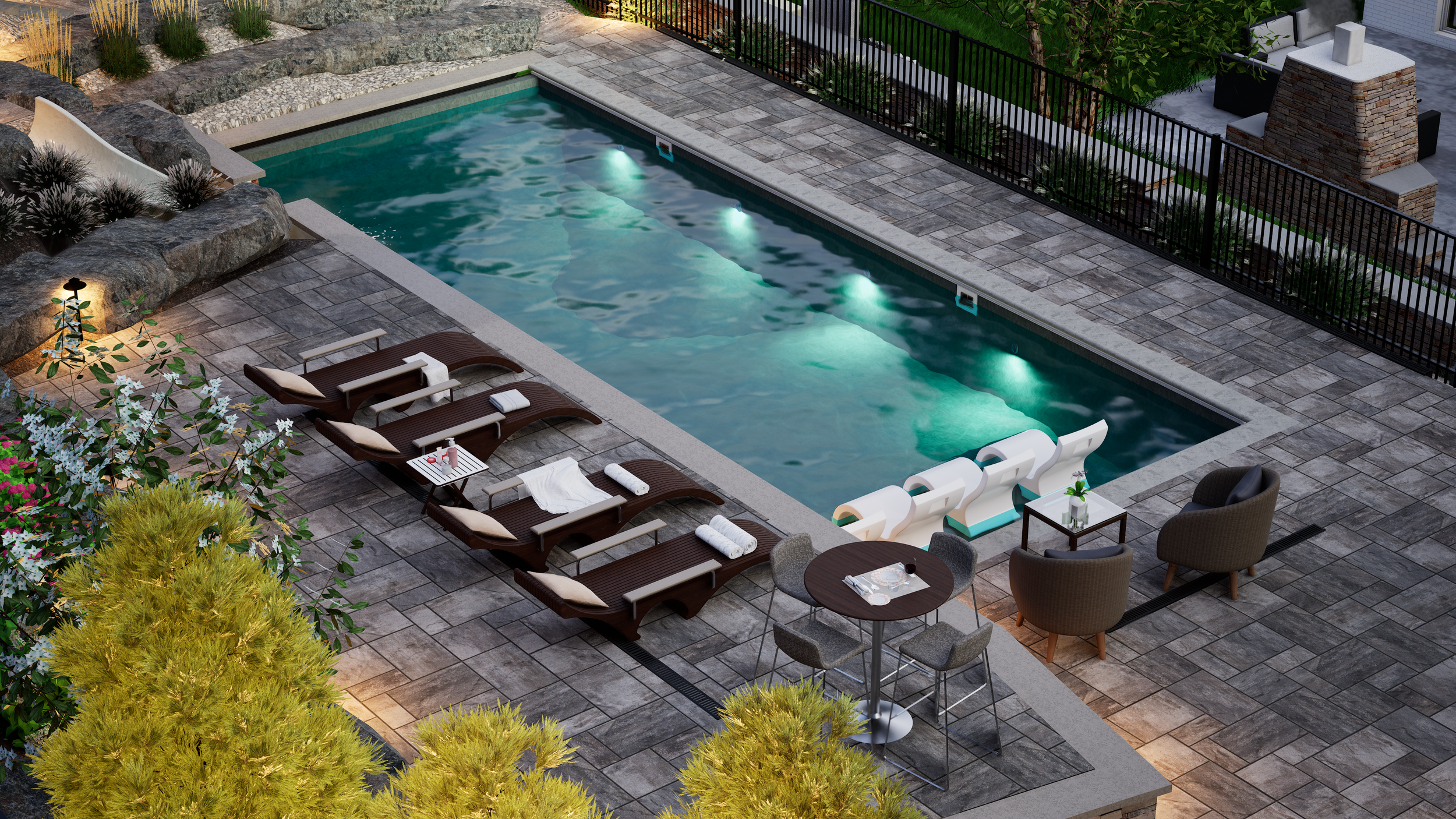
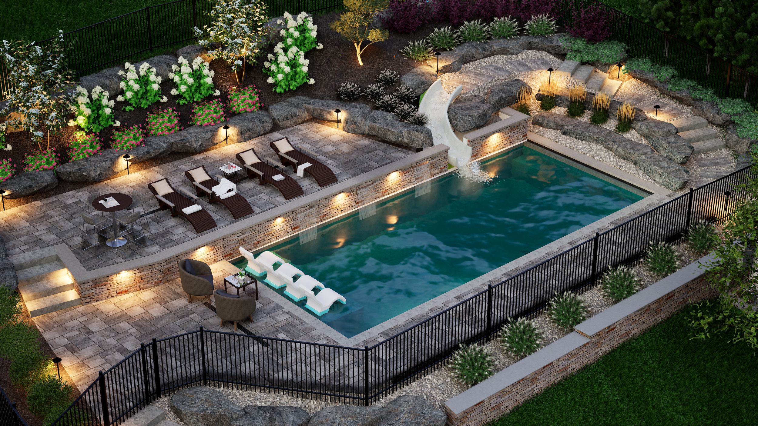
Render of proposed Luxury Outdoor Living Space
PROJECT OVERVIEW
Project Name: Peters Township Pool and Outdoor Living Environment
Location: Peters Township, Washington County, Pennsylvania
Project Type: Turnkey residential outdoor living environment
Pool: 16' x 36' rectangle vinyl liner, approximately 19,000 gallons
Patio: 943 sq ft multi-level paver patio, plus 71 sq ft of walkways
Status: Complete
Completion: 2025
Investment: Approximately $380,000
Services Provided: Reality capture and existing conditions documentation, 3D design, pool design and construction, hardscape, retaining structures, drainage, landscape design and installation, landscape lighting, fencing, project management
EXISTING SITE CONDITIONS
Before any design work begins, understanding what is already there is the difference between a plan and a guess.
The site presented a continuous change in elevation between the house and the upper yard, which meant no usable flat area large enough for a pool and patio without cutting into the hill and retaining what remained. Existing plantings and mature trees framed the space, and some of them were staying. There was existing stone on the property whose color and coursing any new masonry would have to answer to. Access was constrained, which matters more than clients expect: every ton of material has to physically reach the work area, and on this project that included sixty-six tons of boulders.
Water was the quiet problem. On sloped ground, runoff concentrates. Build a flat terrace partway up a hill without planning for that, and you have built a catchment basin with furniture on it.
Key Site Challenges
- No naturally level area large enough for the intended pool and patio
- Earth above the proposed terrace requiring permanent retention
- Concentrated surface and subsurface water movement across the work area
- New masonry needing to match existing stone on the property
- Mature plantings and trees to be preserved or deliberately replaced
- Constrained site access for heavy material delivery
- Step and stair layout dependent on final field grades
That last one was written into the contract before construction began. The documents flag that step layout may require adjustment in the field depending on the land. We do not consider that a hedge. It is an accurate statement about building on grade, and the way you shrink that uncertainty is by measuring the site properly first.
CAPTURING EXISTING CONDITIONS THROUGH REALITY CAPTURE LiDAR Scanning and 3D Intelligence Gathering
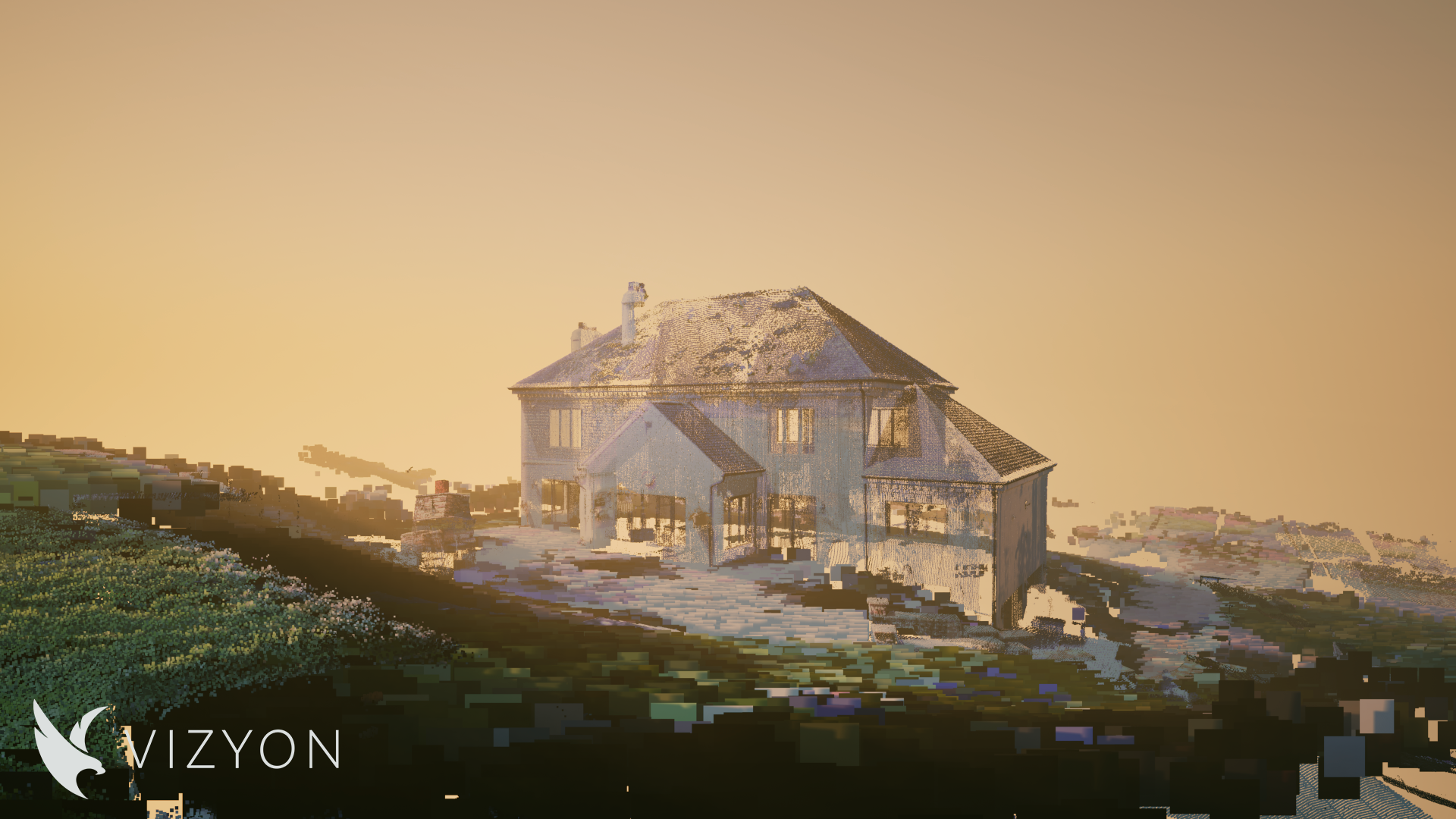
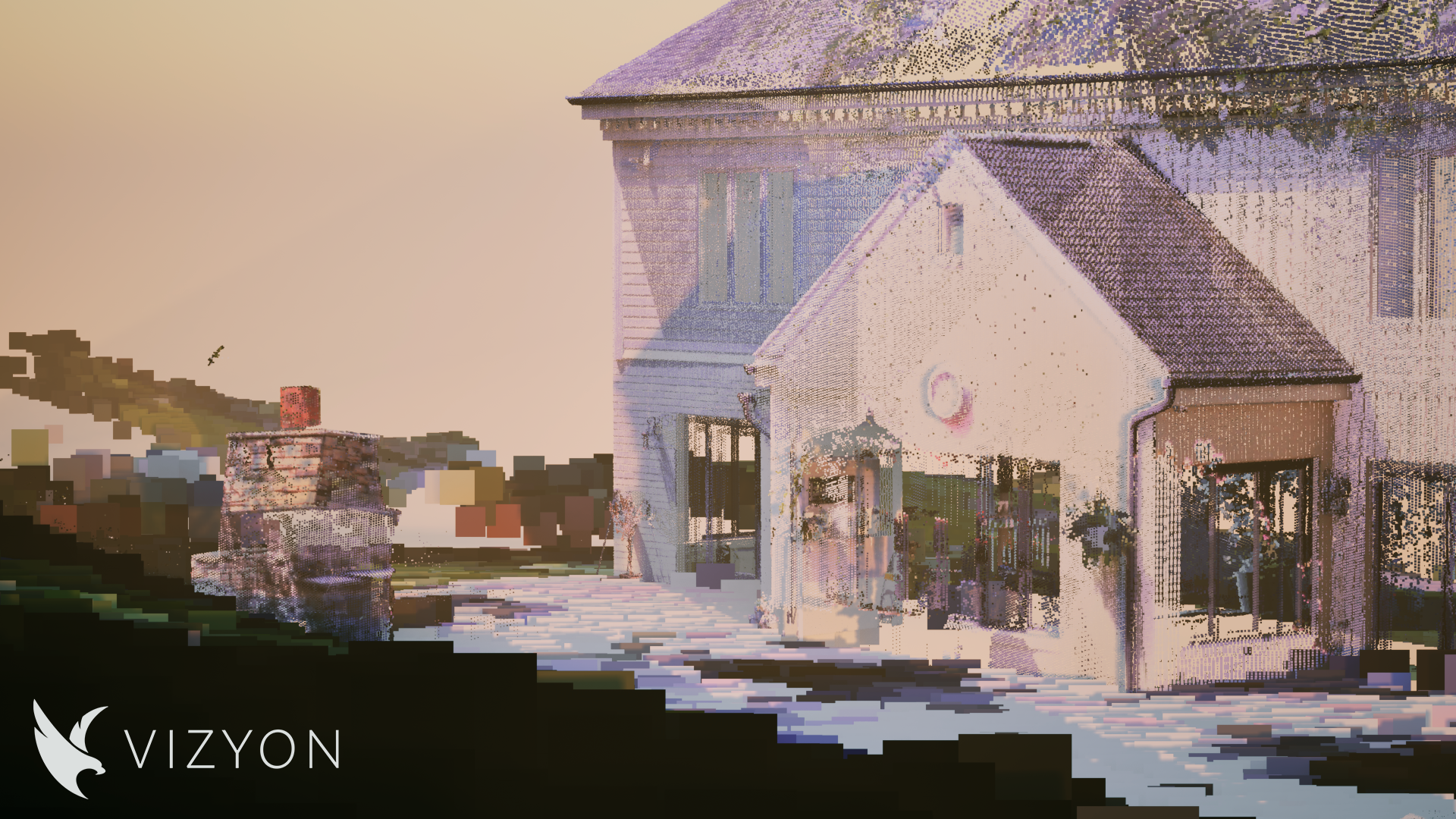
We captured this site with a Trimble SX10, an instrument that combines survey-grade measurement with 3D laser scanning. Rather than taking a handful of spot measurements with a tape and a level, it records the site as a dense field of measured points, a point cloud, describing the actual geometry of grades, structures, existing walls, and plantings as they exist.
For a reader new to the term: reality capture means producing a measured digital record of a property before anyone designs on it. A point cloud is that record in its rawest form, millions of individual measured points in three dimensions. Everything downstream, the model, the drawings, the renderings, the material quantities, is built on top of it.
On flat ground you can get away without this. On this site you could not. When the finished elevation of a pool terrace depends on how much earth is being cut and how much is being held, an approximation in the site data becomes a problem in the field. Specifically, the scan let us establish where the flat plane could sit, how tall the retaining structure needed to be, how the boulder tiering above it would course, and how the drainage would fall. Those four answers are related. Change one and you change the others, which is exactly the kind of problem you want to solve in a model rather than discover with an excavator on site.
Benefits of reality capture on a project like this one
- The design is built on the property's real geometry, not an estimate of it
- Fewer return trips to the site for measurements
- Conflicts in grade and drainage surface during design, when they are cheap
- Material quantities on complex grades can be calculated rather than guessed
- Everyone, homeowner, designer, and field crew, works from the same record
- The client can see and experience the space before it is built
- The record outlives the project and remains useful for future work
THE DESIGN PROCESS
Translating Data Into Design
With the site recorded, the design moved into three dimensions, and the value of working that way showed up in a decision most clients never hear about.
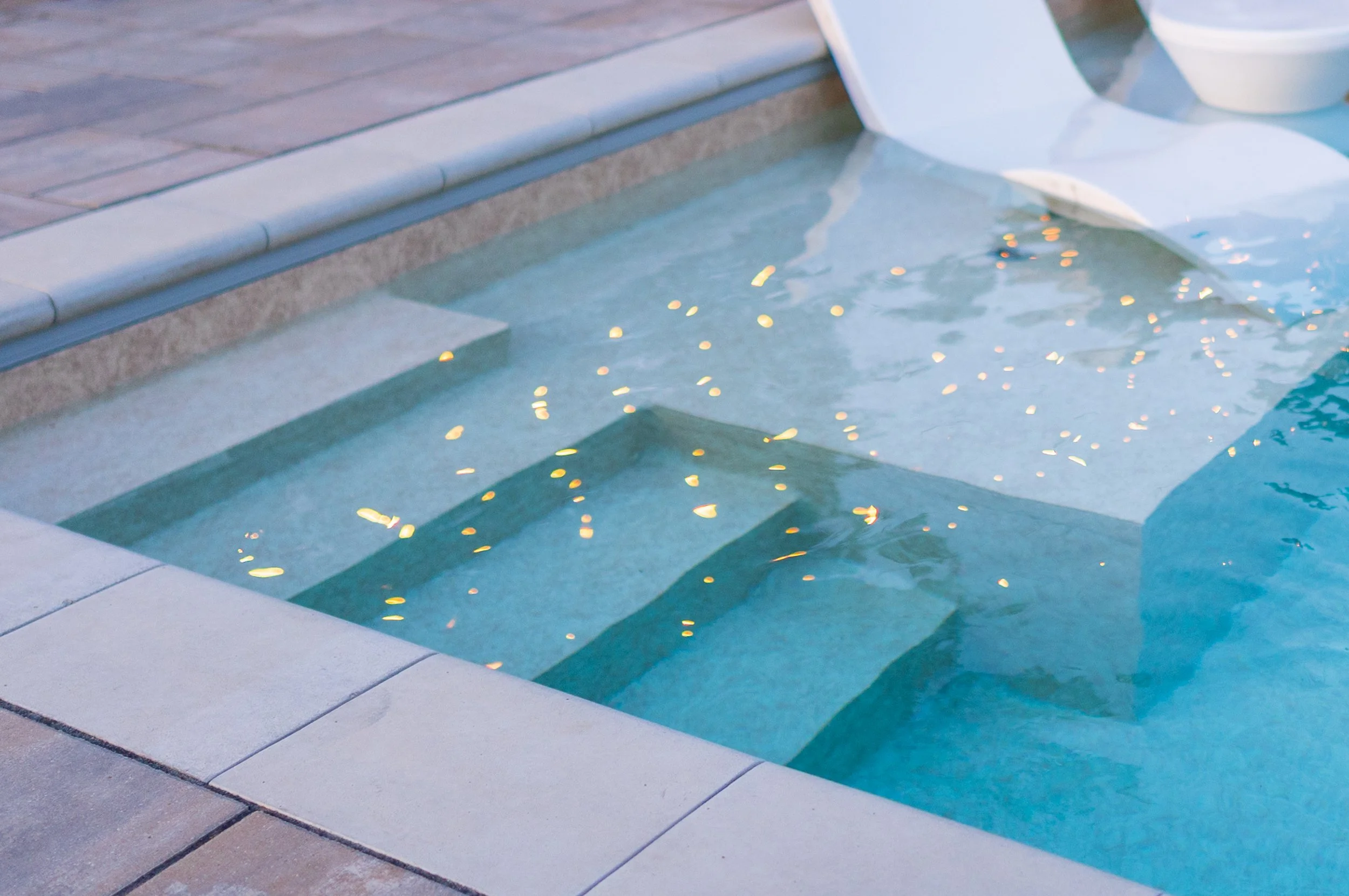
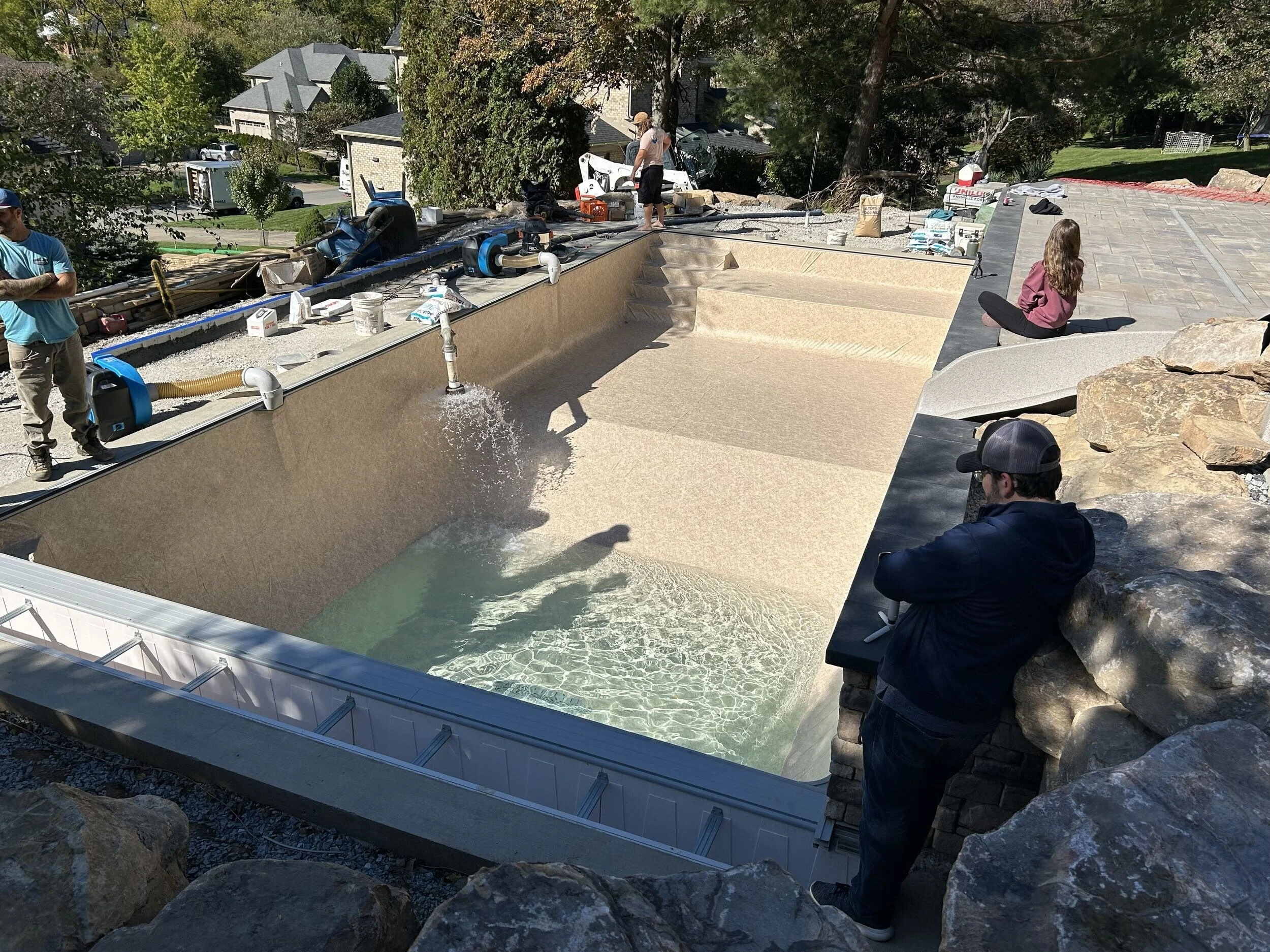
The first pool layout placed the sun deck on the first step tread. On paper, that is a sun deck. In practice, it would have held only two to four inches of water, and once evaporation was accounted for on a hot week, potentially as little as an inch. A shallow shelf with an inch of water on it is not a tanning ledge. It is a warm puddle, and the family would have discovered that in July of the first season.
The revised layout moved the tanning ledge to the second step tread, where it holds a usable depth, deepened the deep end to seven feet, and added two permanent umbrella anchors set into the ledge, spaced to take three chairs and sized for six-foot shades. That is a small change on a drawing and a large change in how the space actually gets used. It was caught because the design was reviewed in three dimensions against a measured site, before anything was built.
Design Considerations
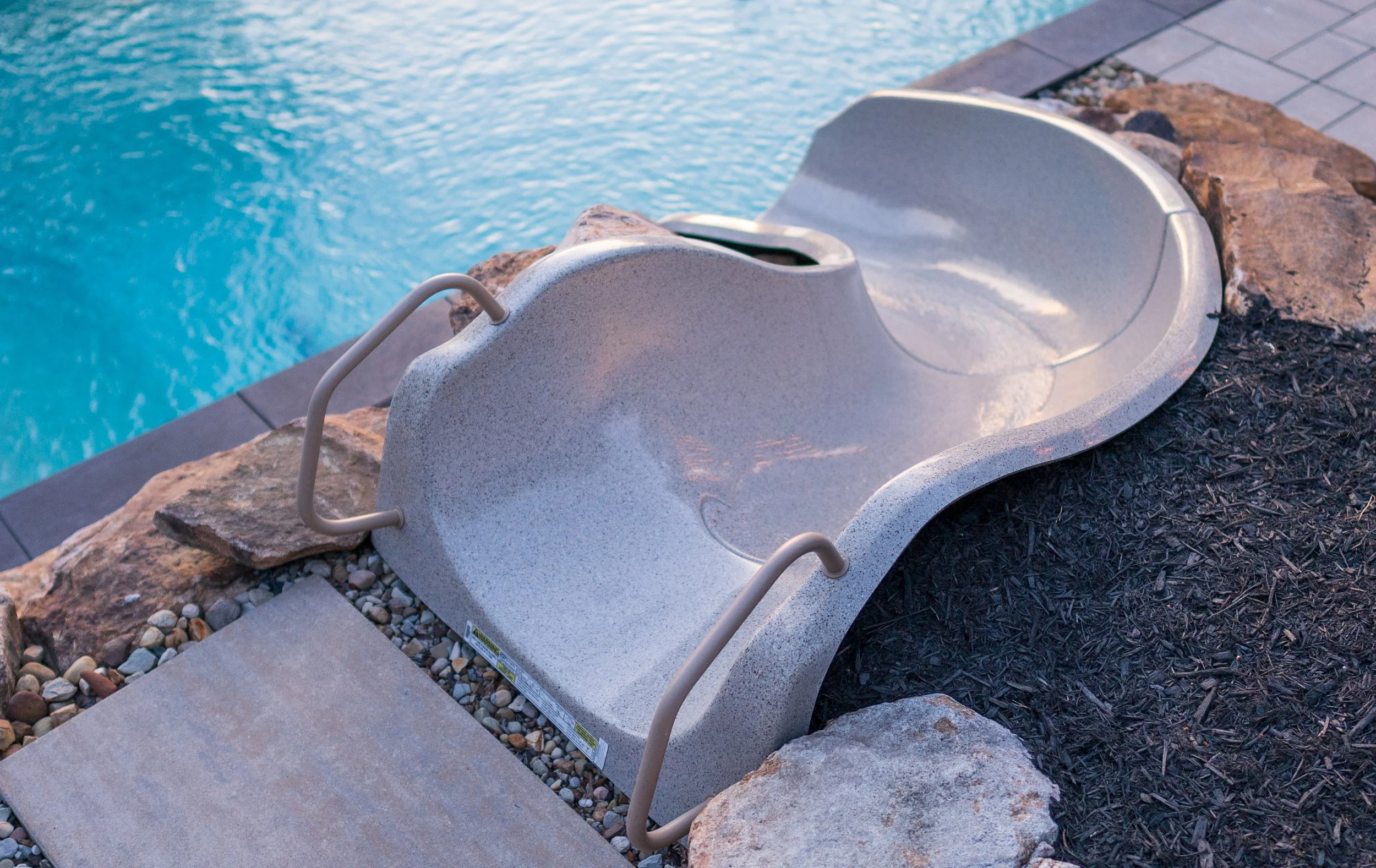
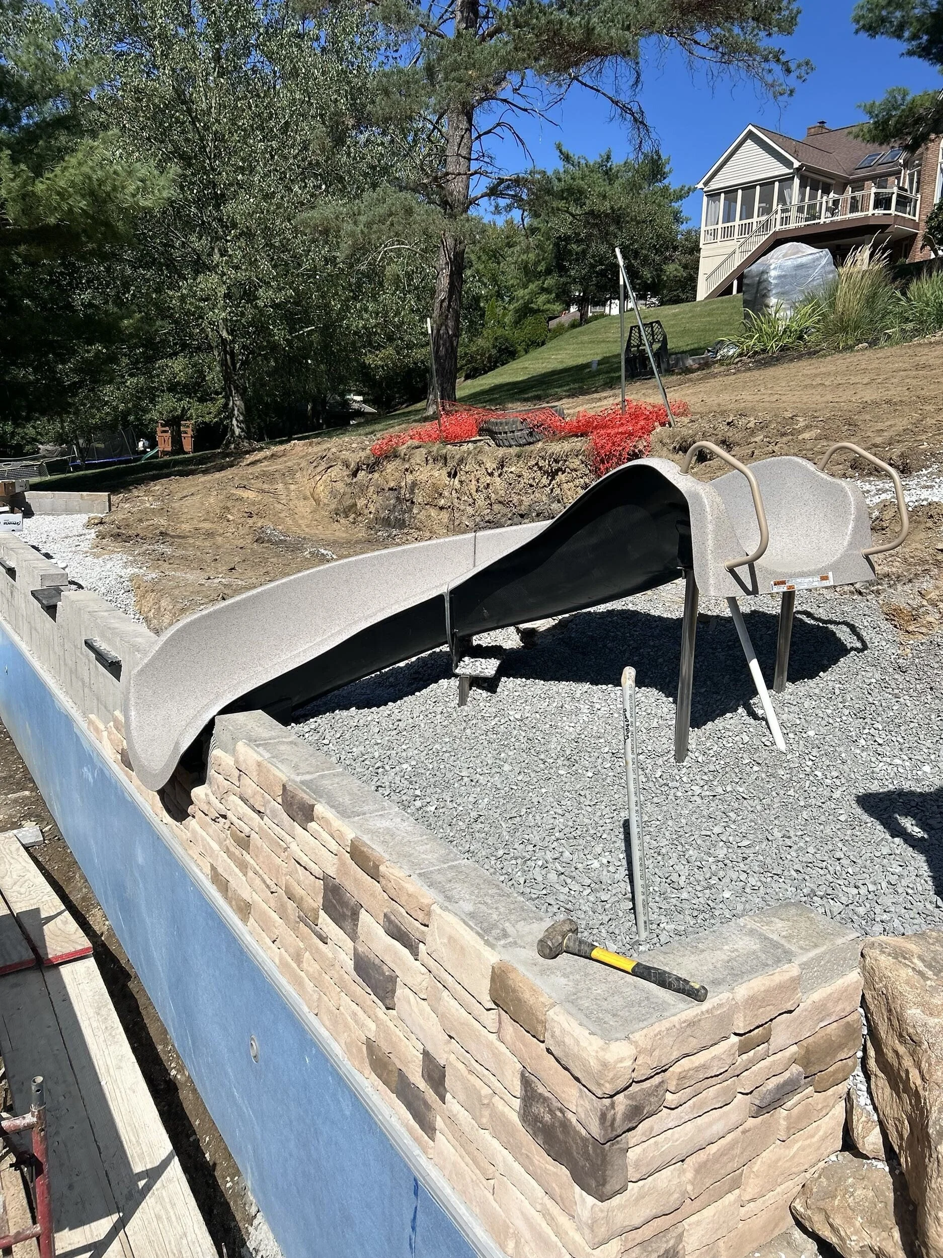
Functionality. The pool carries a tanning ledge, a full-length bench along the deep end with a corner step, and a slide. Circulation was designed at roughly 19,000 gallons on a twelve-hour turnover, with two skimmers, a channel main drain, and two returns. An automatic cover with a walk-on lid assembly handles the practical reality that a pool in Western Pennsylvania is closed more months than it is open.
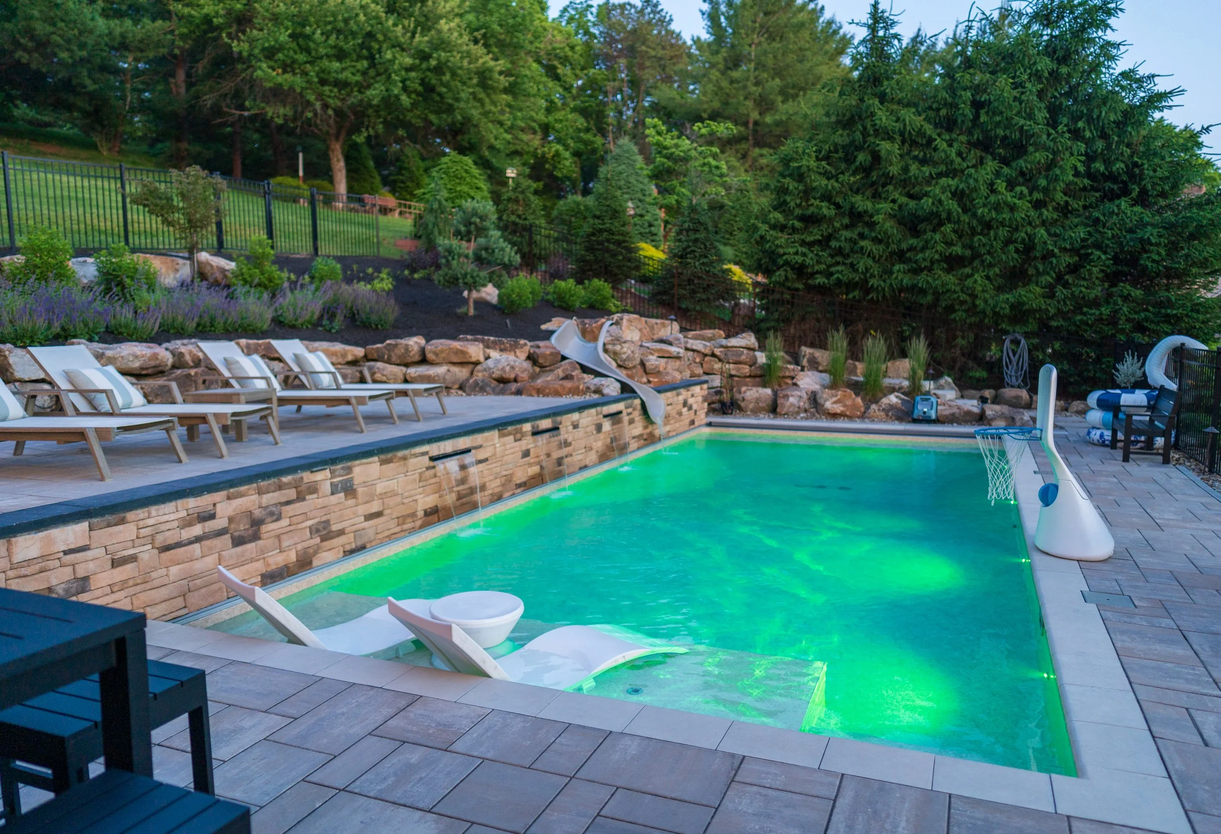
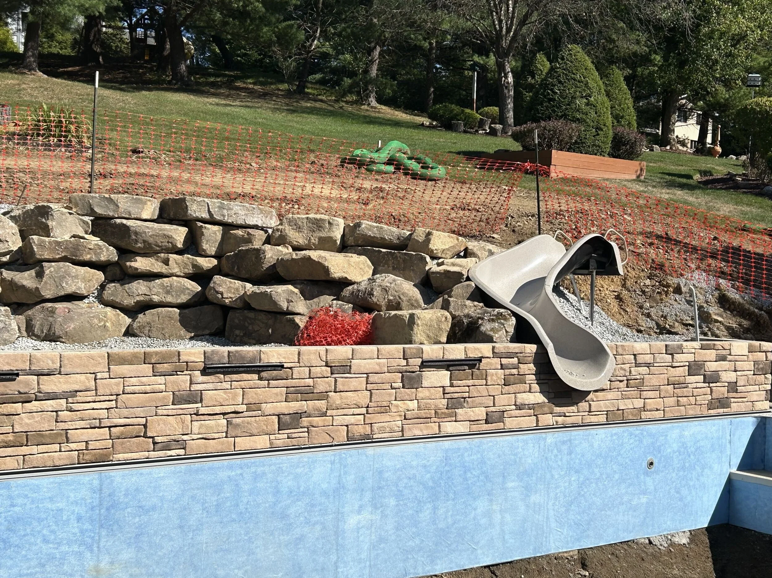
Aesthetics. The paver field is Beacon Hill Fossil Smooth in a random pattern, with Blockhouse limestone bullnose coping at the water and charcoal straight-cut coping on the feature wall and over the cover. The 28-mil liner is Merlin Island Beaches. The retaining wall is faced in Provia Seneca Drystack, and the selection record for it says only "to match existing," which is the whole instruction. New stone on this property was not going to announce itself.
Sustainability and performance. A variable-speed circulation pump, a salt chlorine generator, LED lighting throughout, and a single automation platform controlling pump speeds, heat, lighting schedules, and water features. The efficiency case for variable speed is straightforward, and the practical case is that the family can run the system from a phone.
Constructability. Every part of this design had to be buildable on grade by a crew working with constrained access. The drainage was designed as part of the structure rather than added to it. The boulder tiering performs both aesthetic and structural work.
KEY ARCHITECTURAL FEATURES
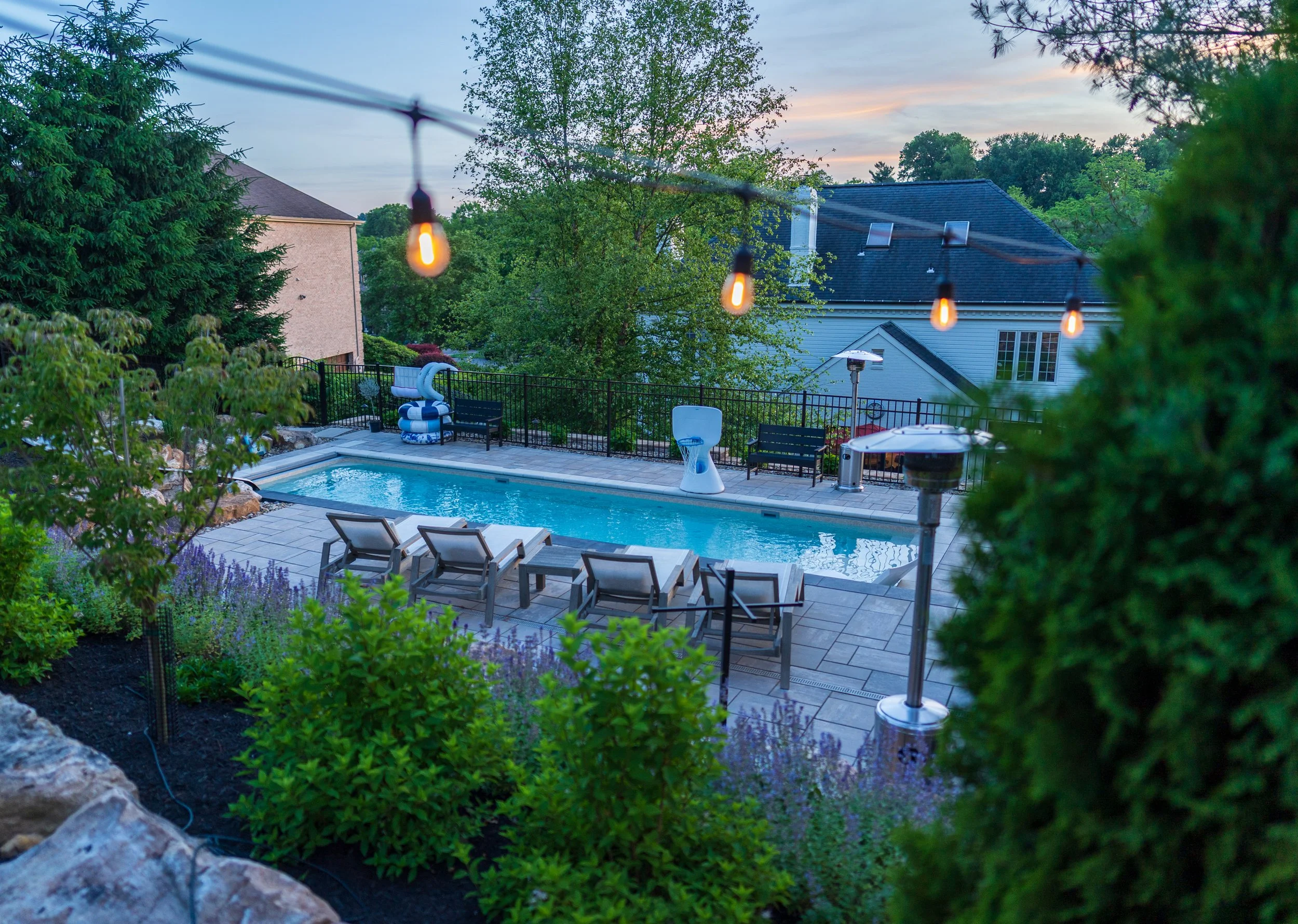
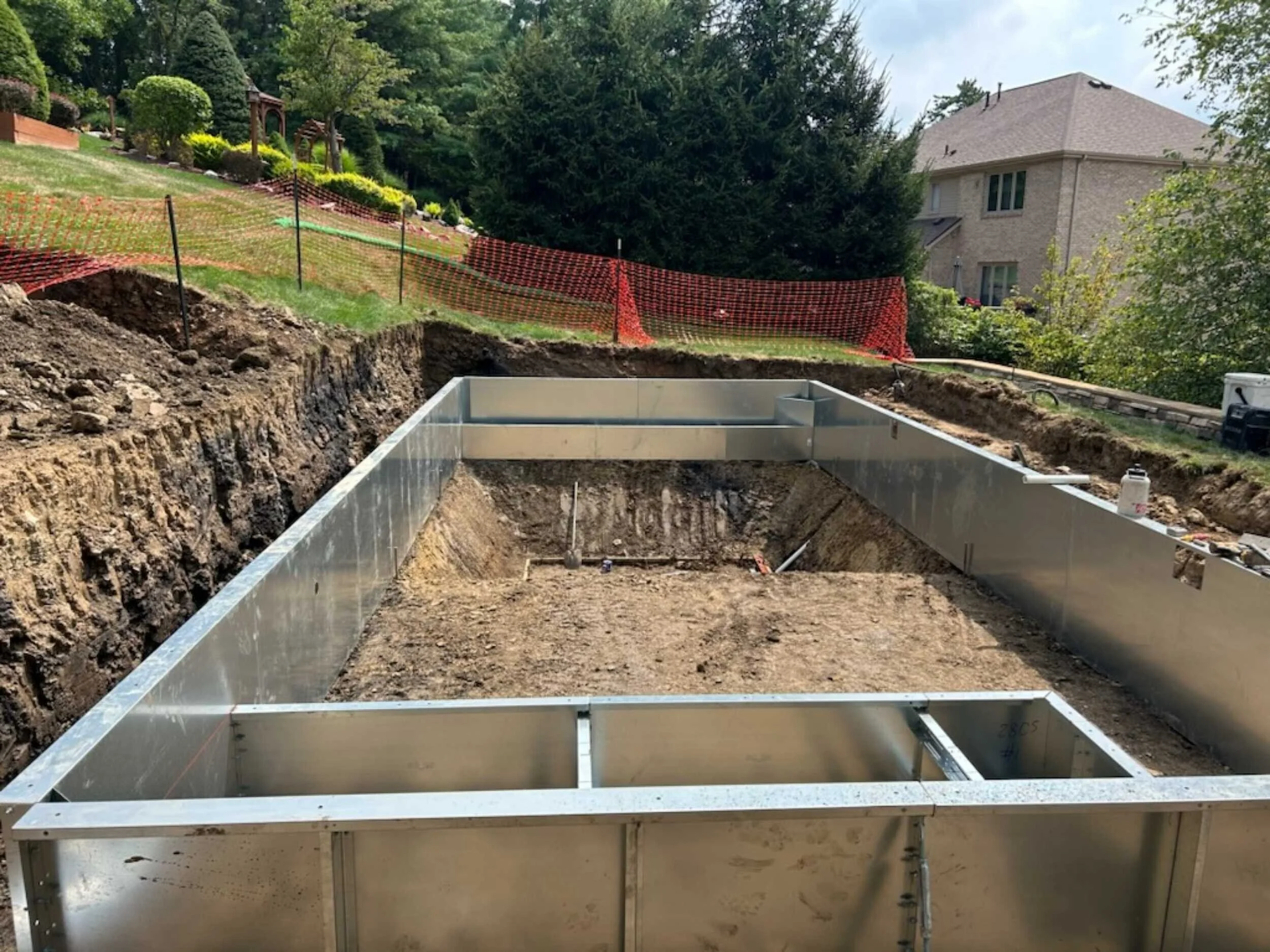
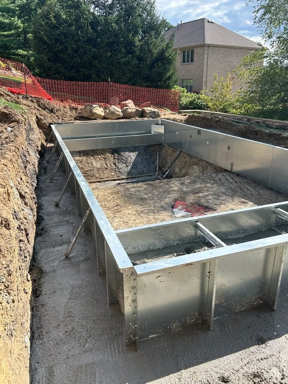
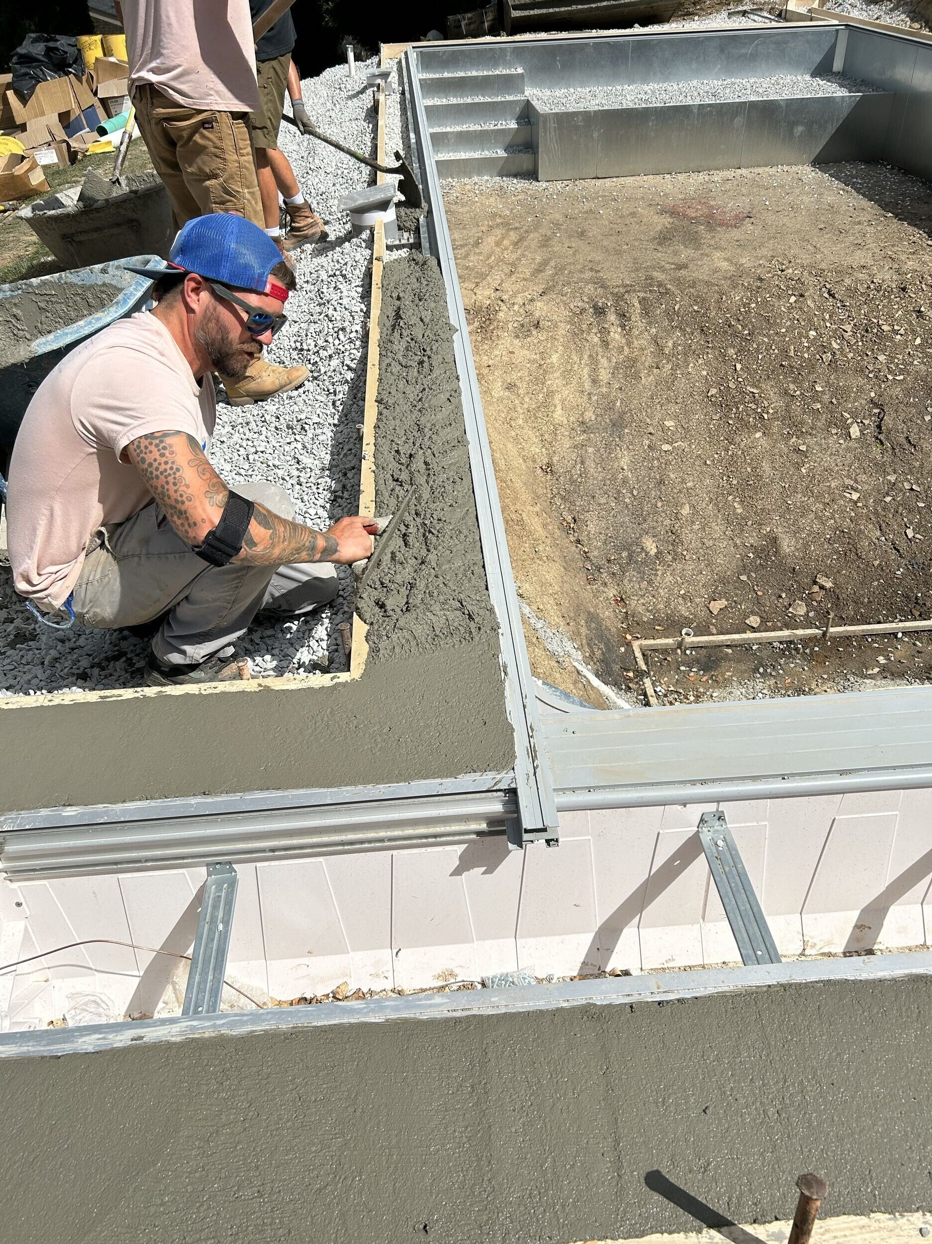
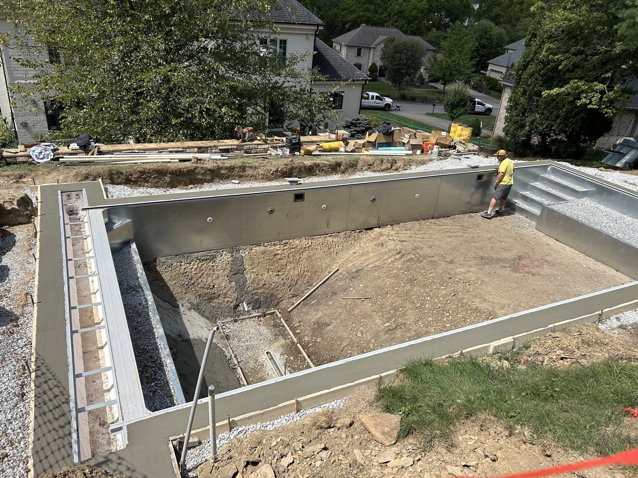
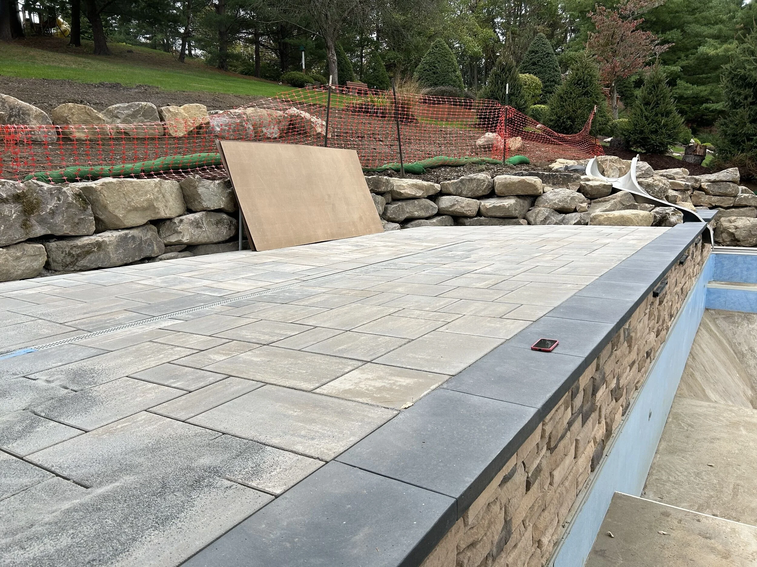
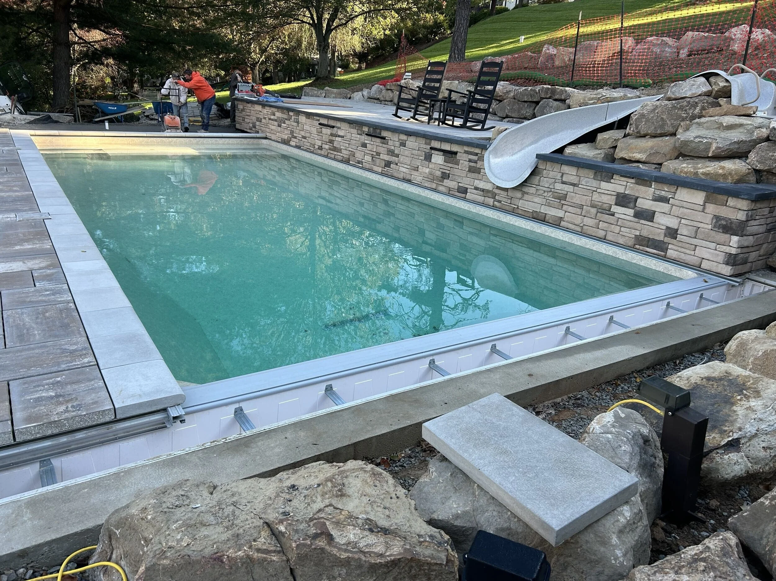
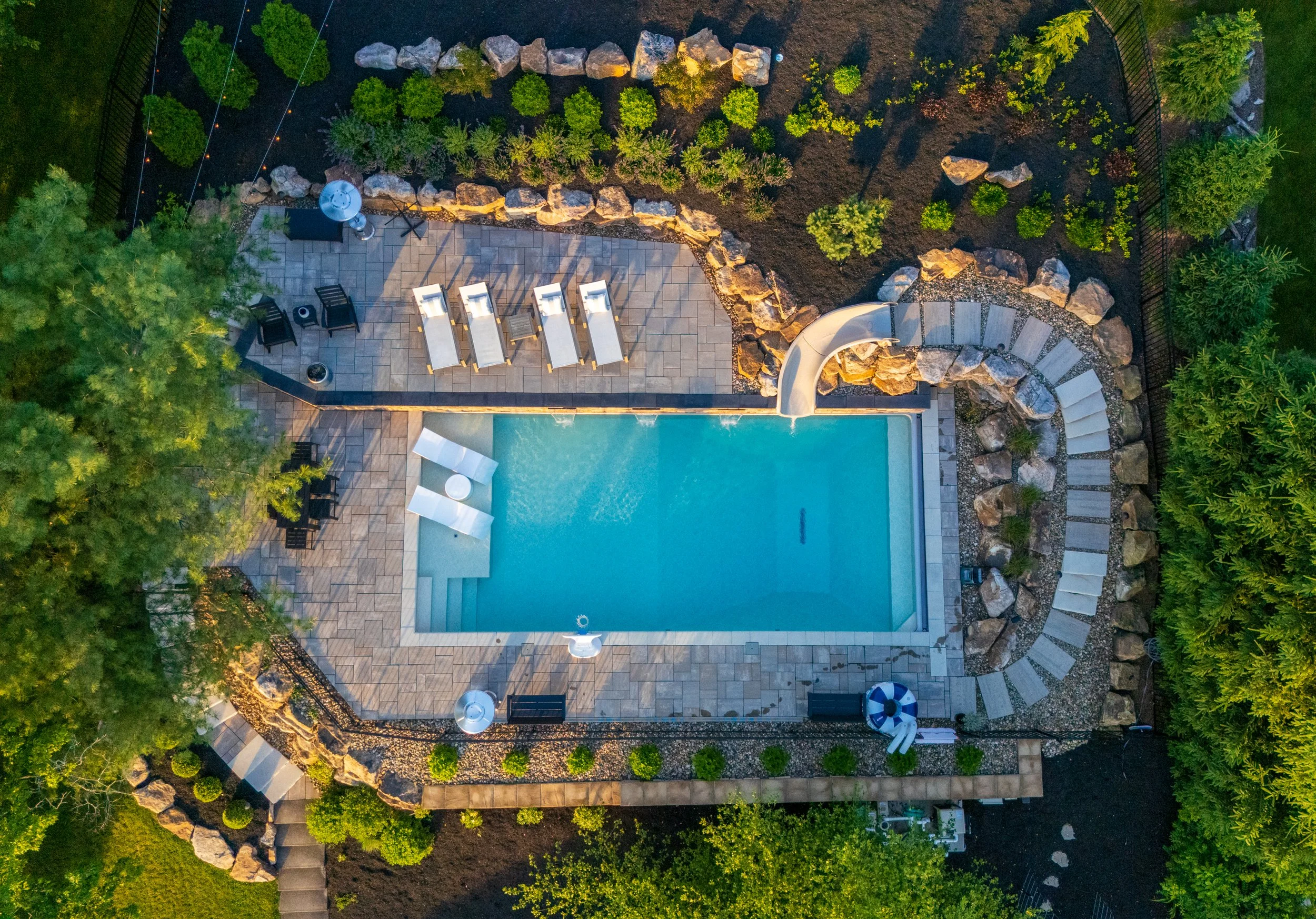
The pool. A 16 by 36-foot rectangle with 42-inch galvanized steel walls, a troweled vermiculite bottom, a tanning ledge, and a full-length deep-end bench. Footers poured below frost line. Simple geometry, deliberately, because on a site with this much going on, the water should be the calm thing.
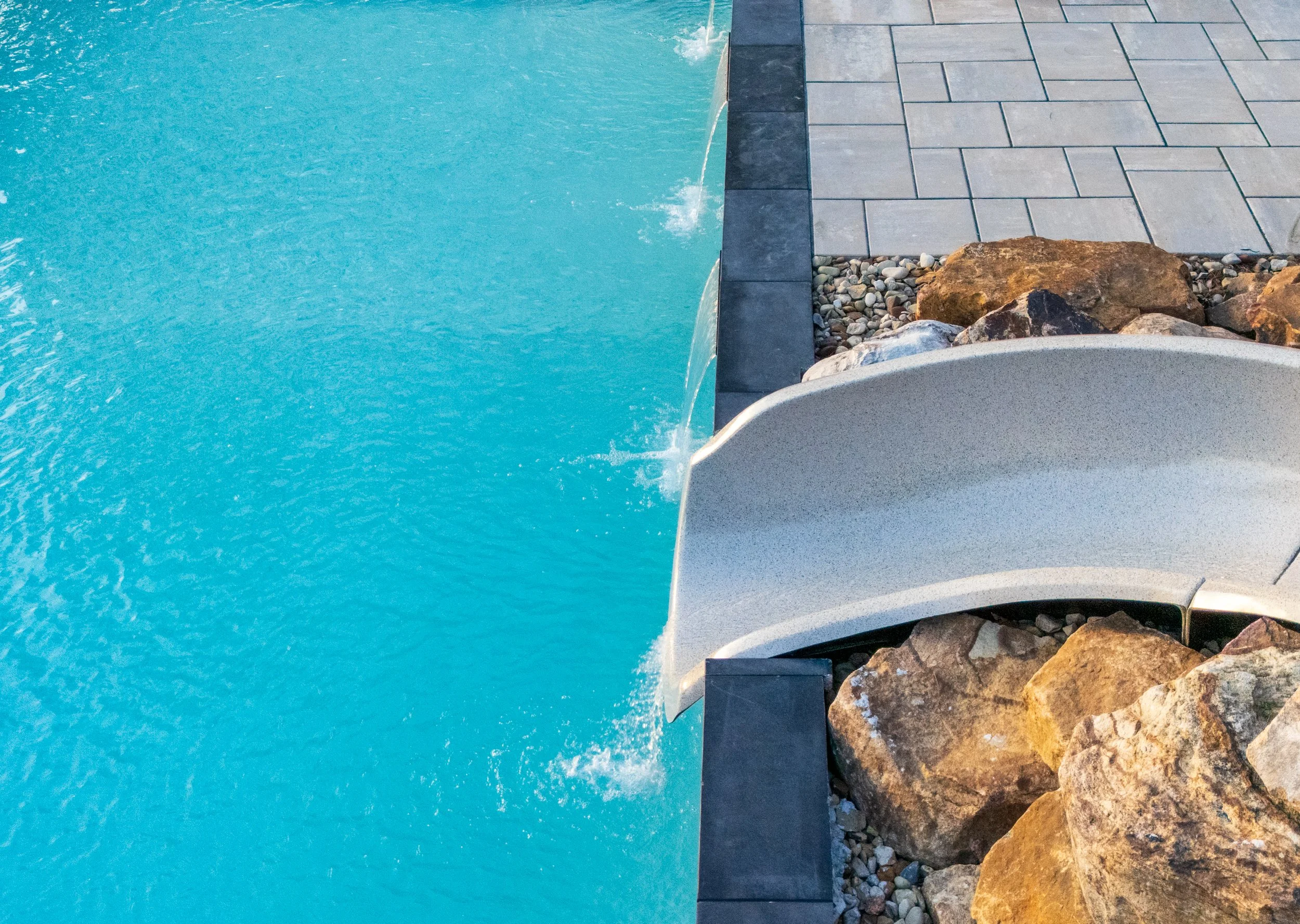
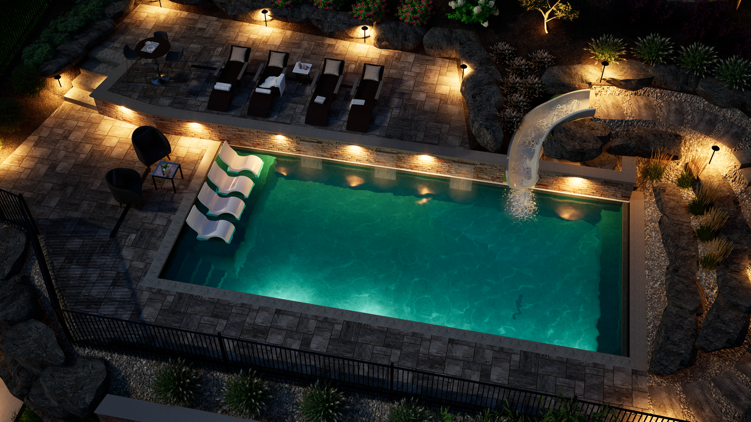
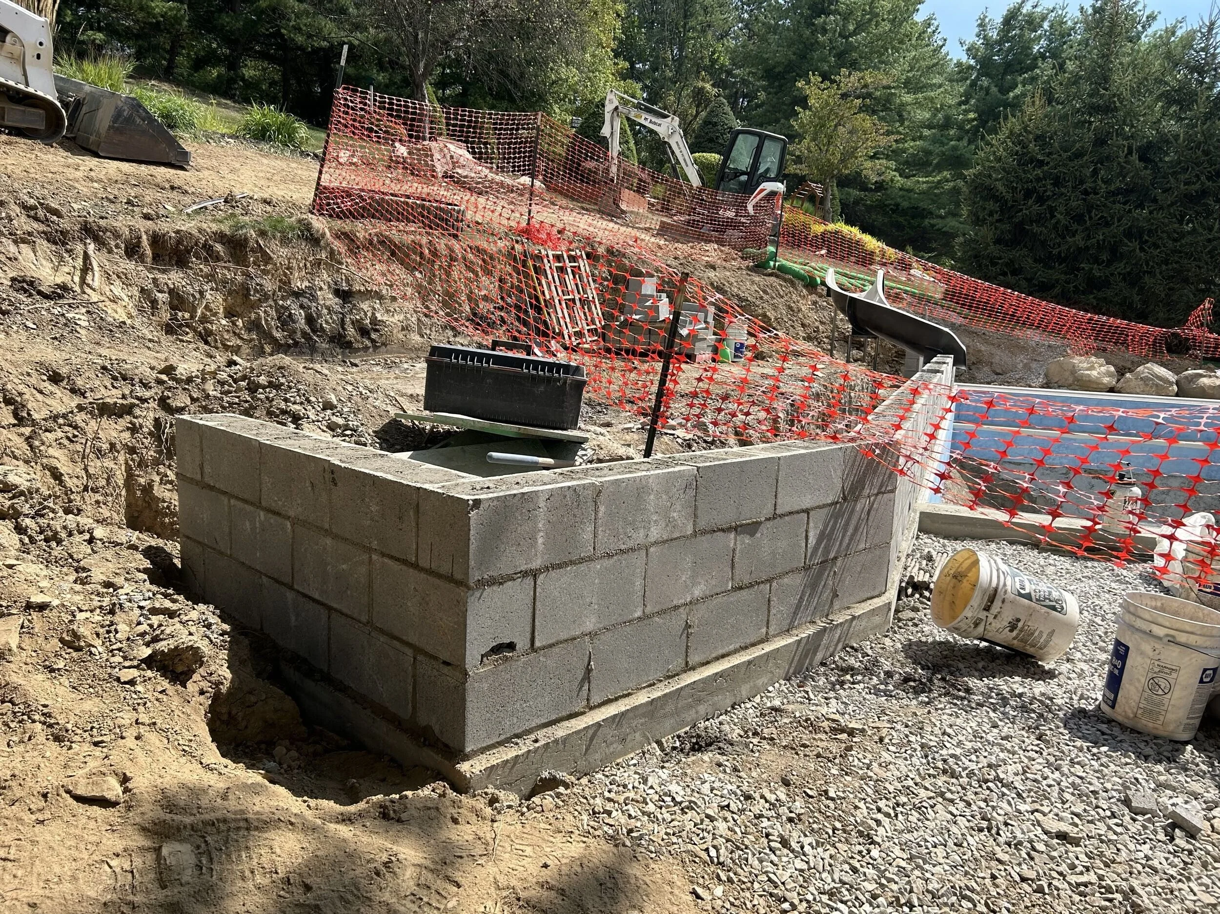
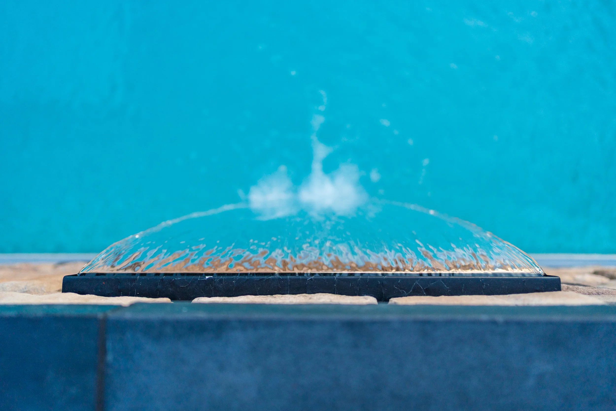
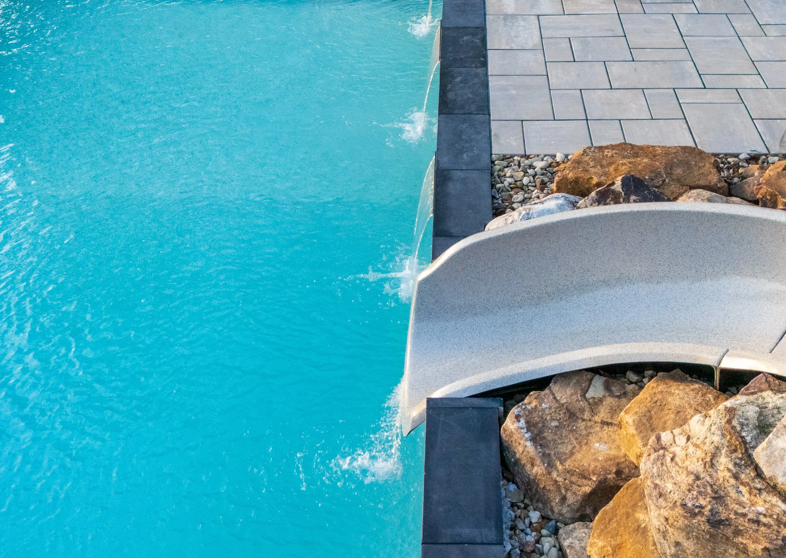
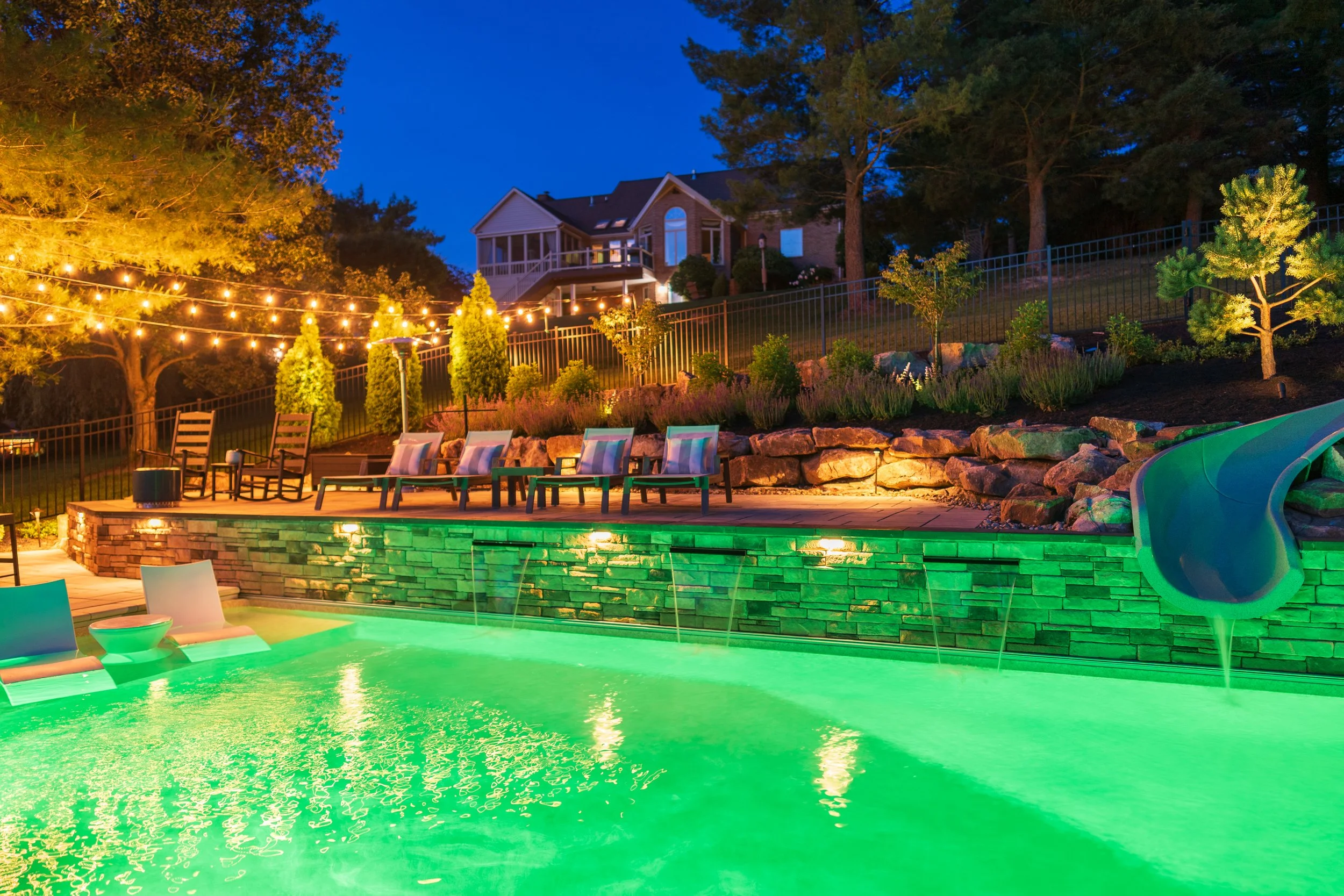
The feature wall and its water. A 58-foot raised bond beam and retaining wall built in reinforced CMU on concrete pylons, faced in dry-stack stone, carrying three 24-inch sheet-flow scuppers that fall into the pool. Each scupper is independently valved and rated at 20 to 60 gallons per minute, so the water can read as a whisper or a curtain, depending on the evening. The wall is doing three jobs at once: it retains, it defines the upper edge of the terrace, and it is the thing your eye goes to.
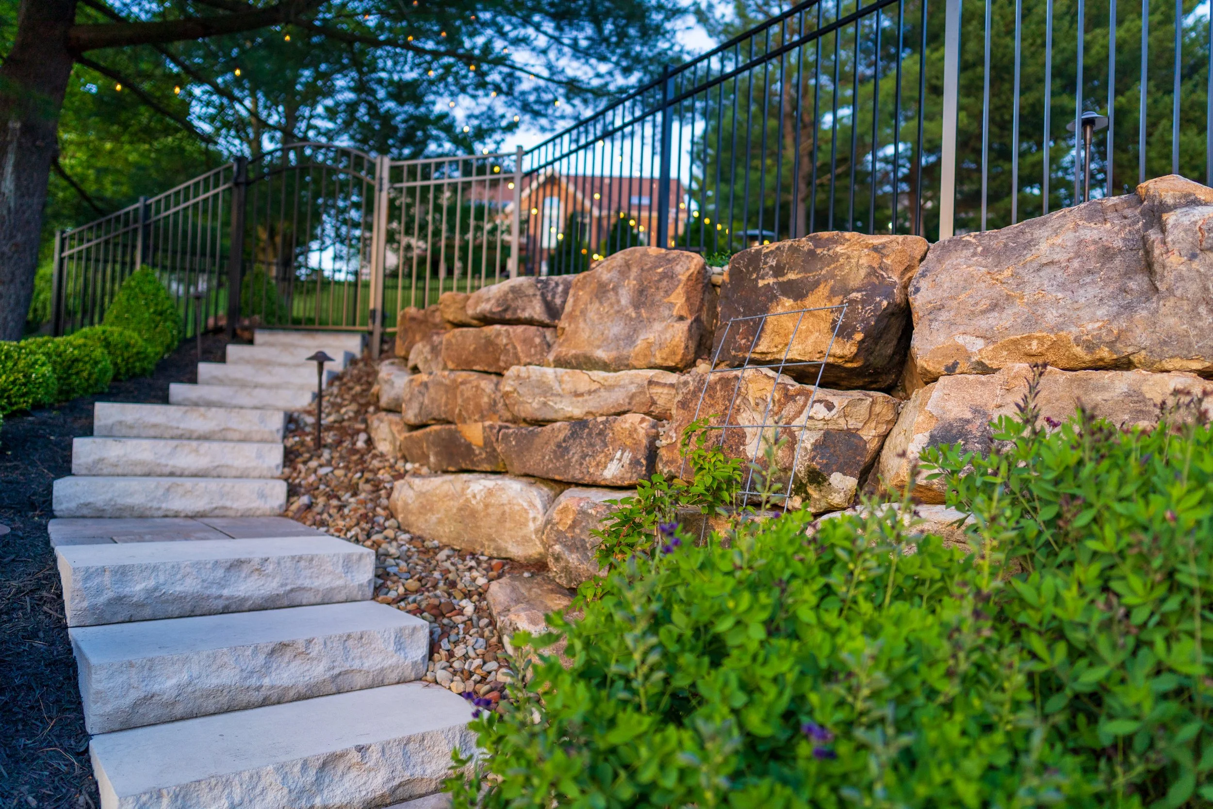
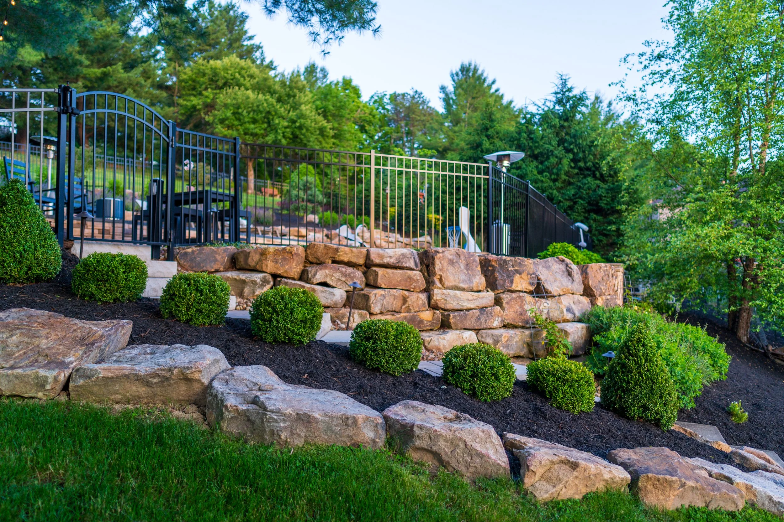
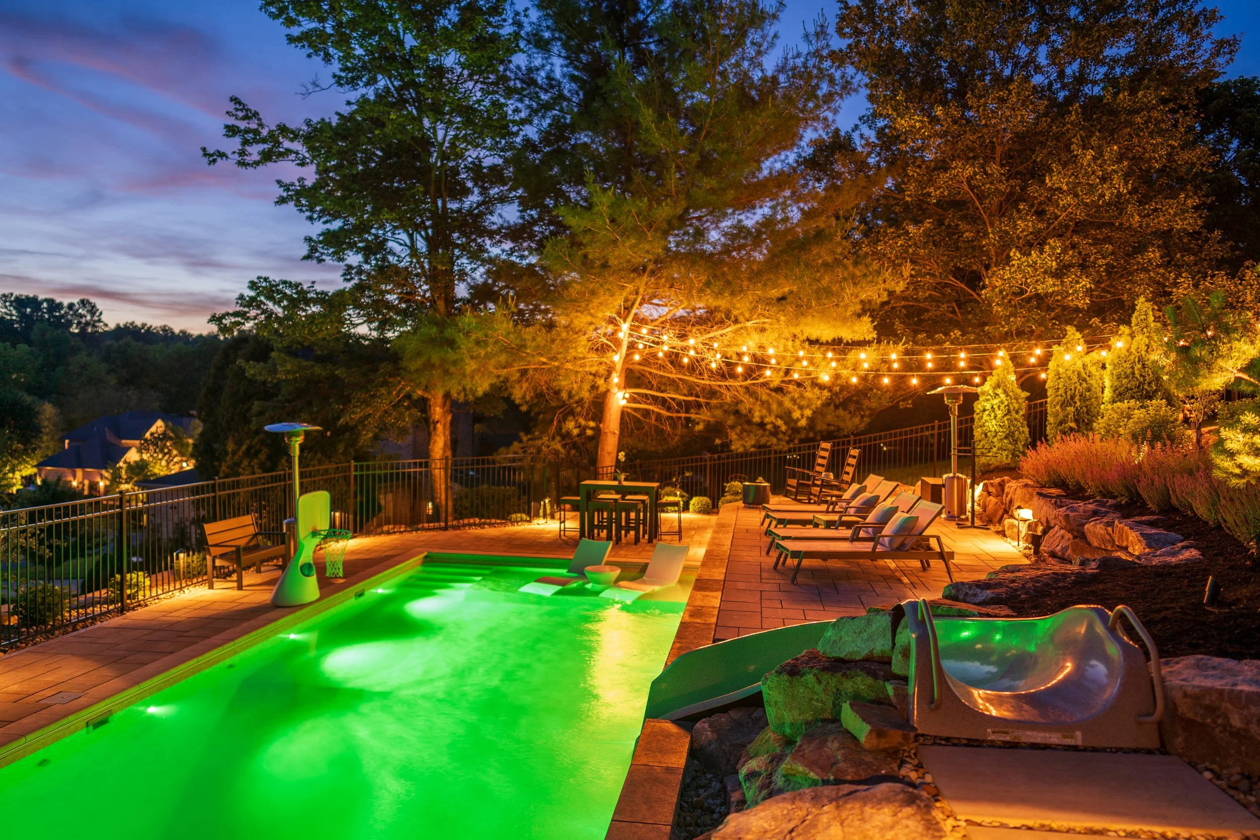
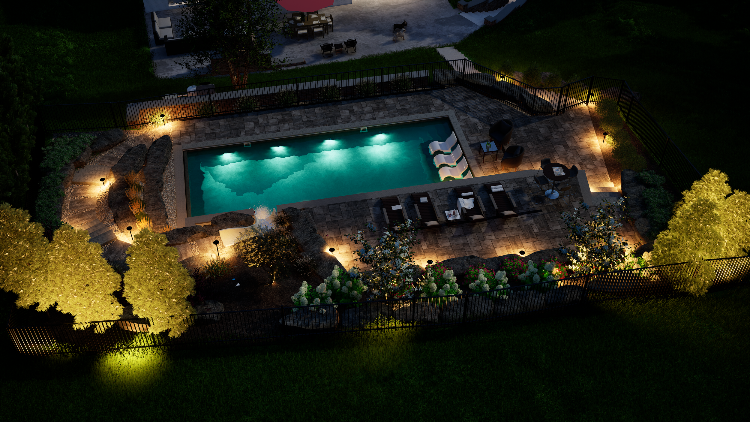
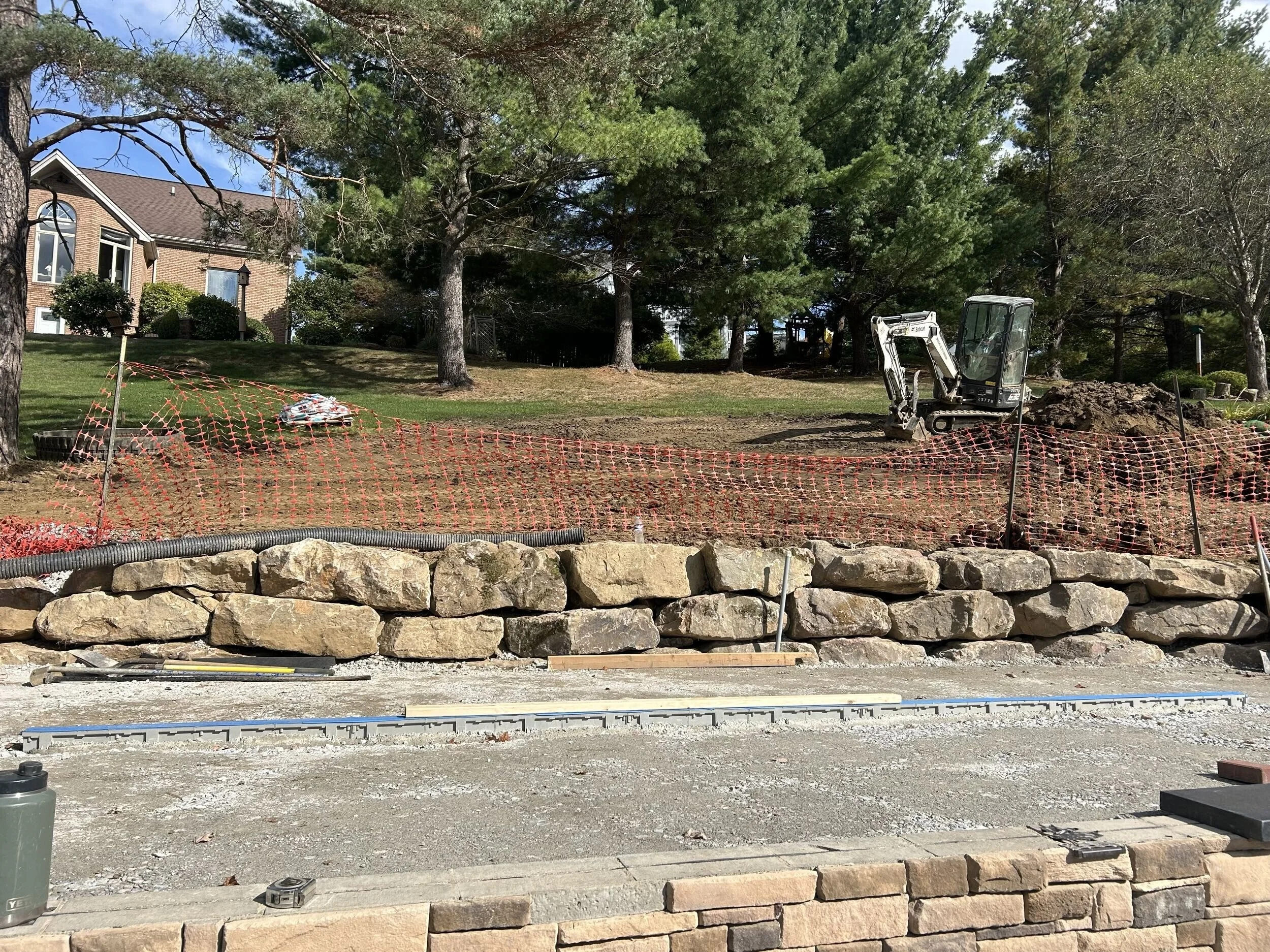
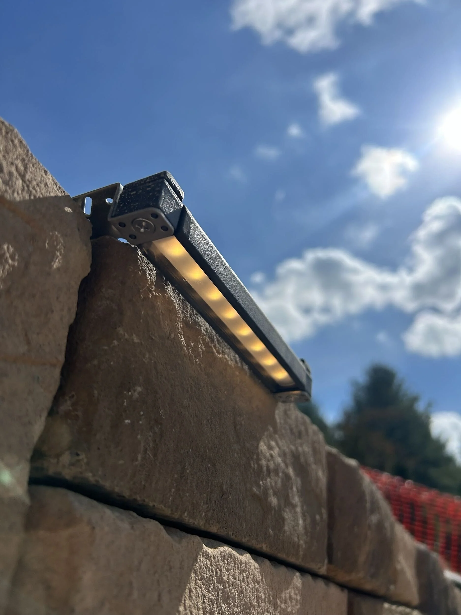
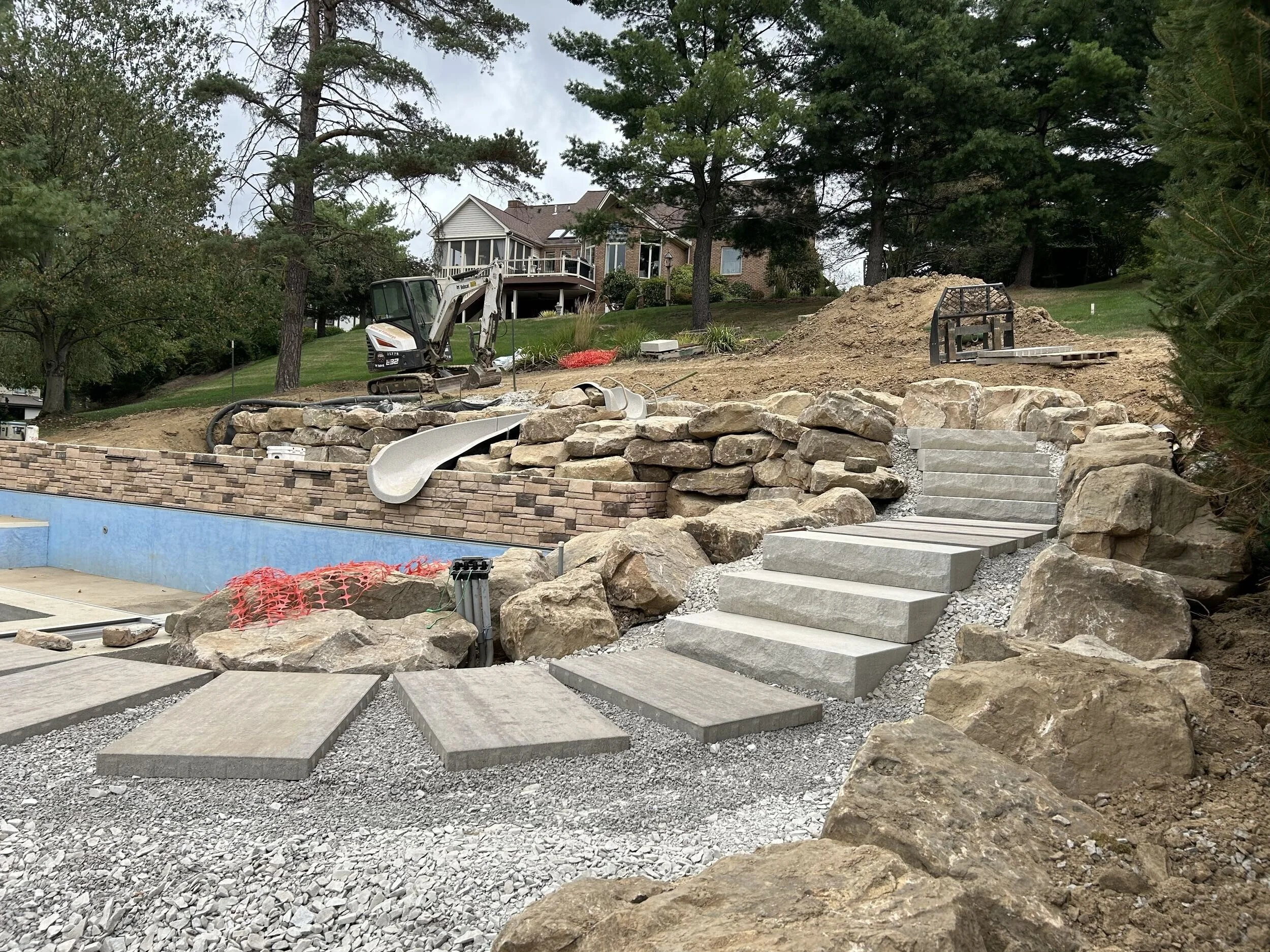
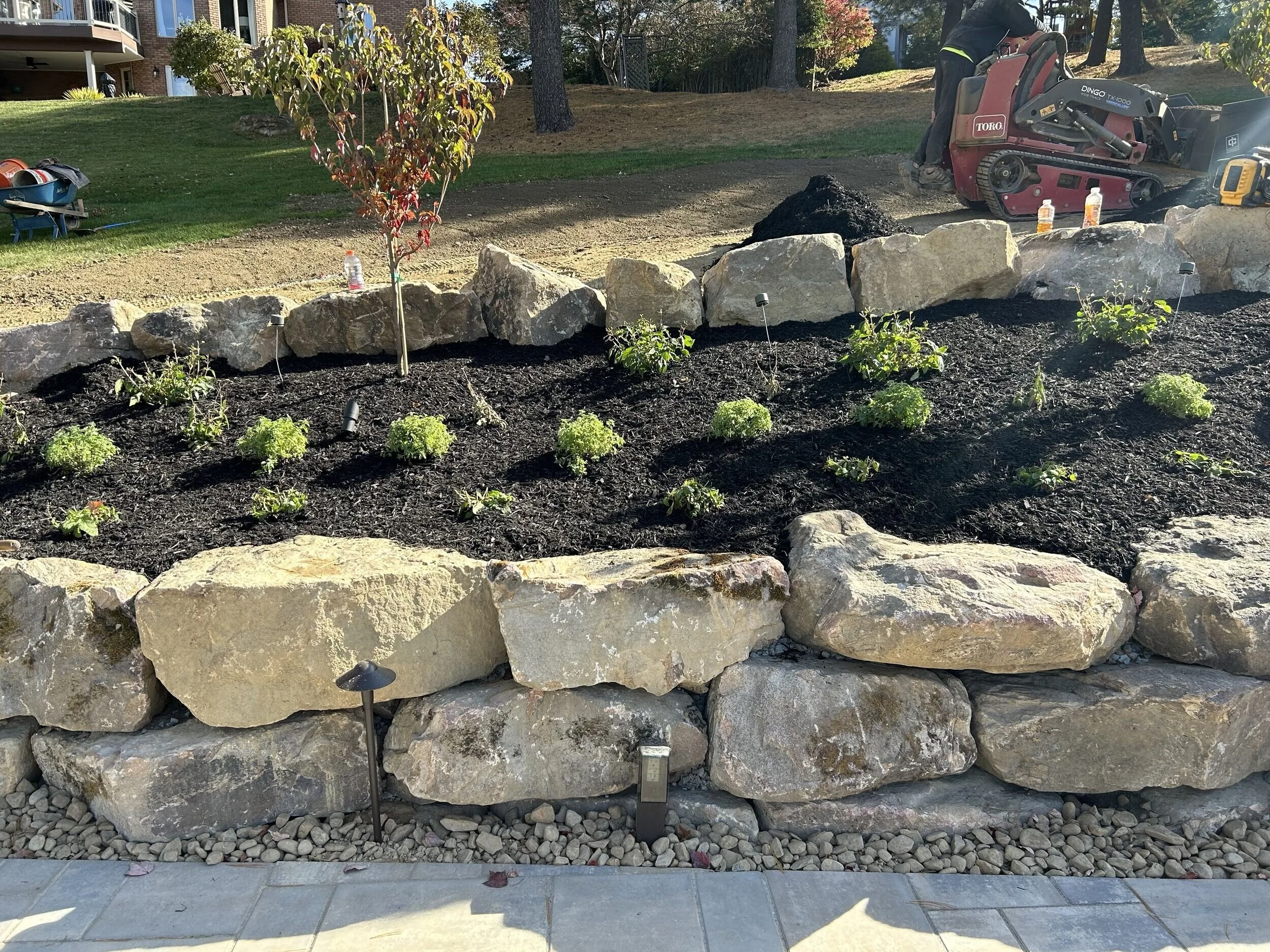
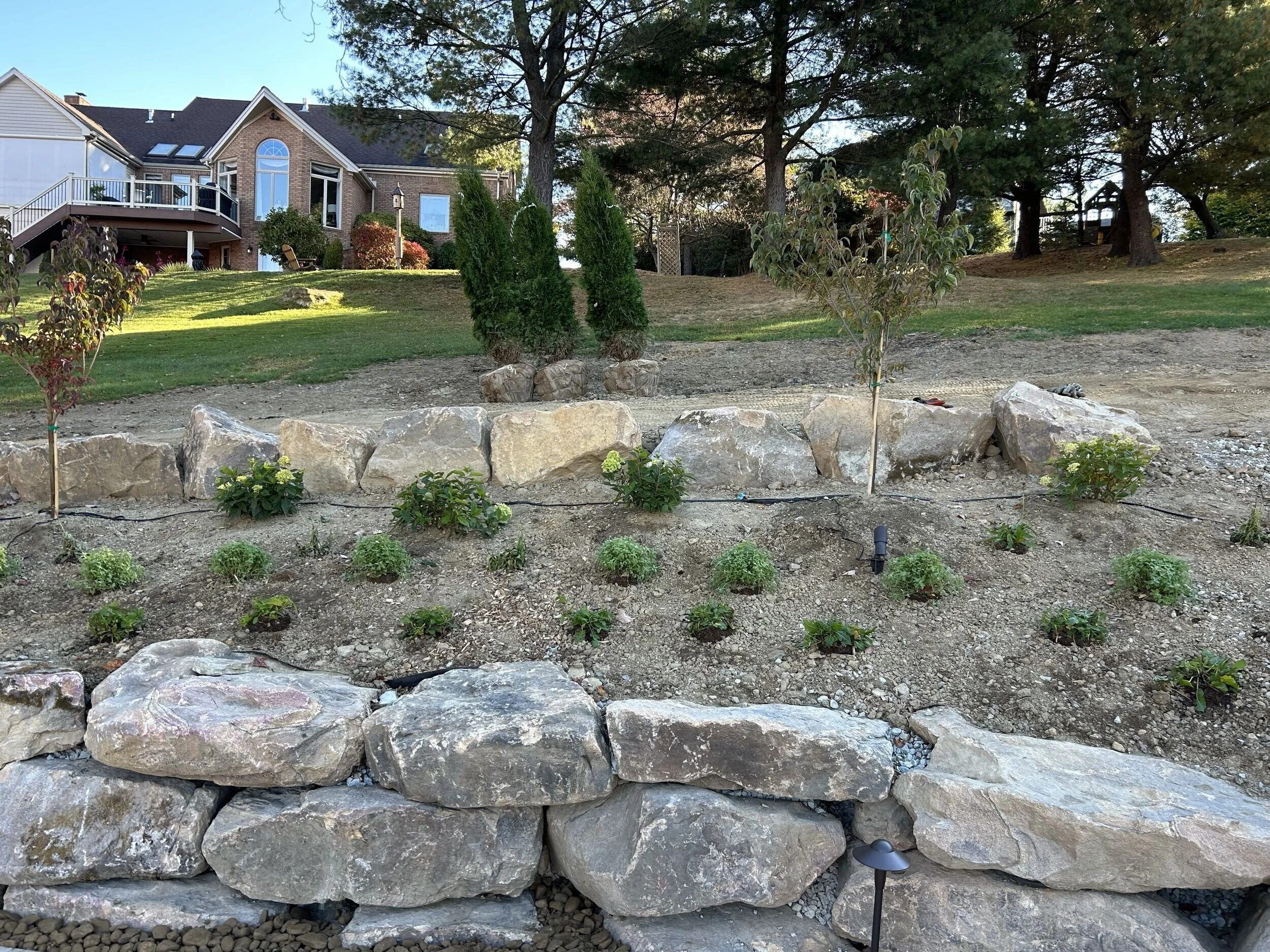
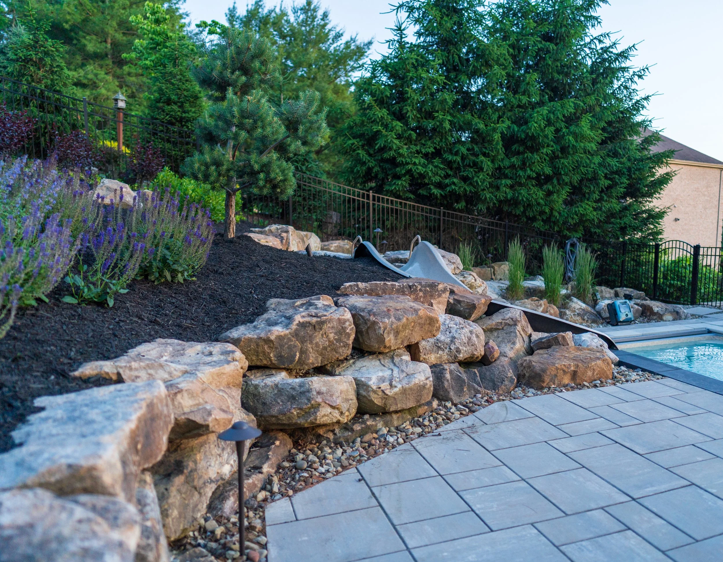
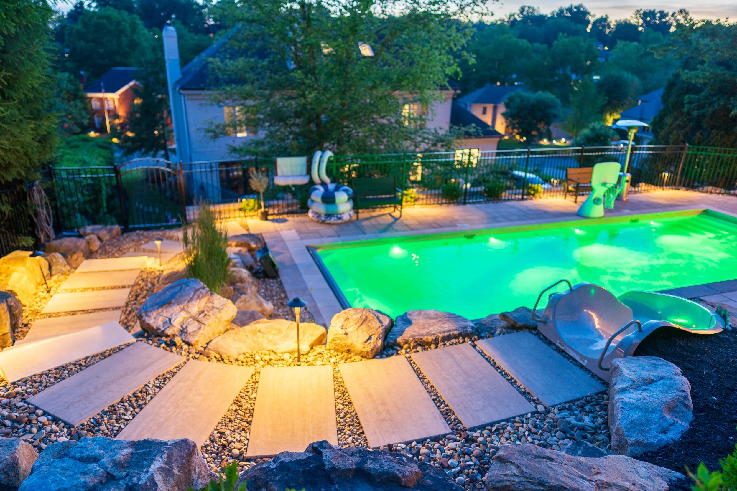
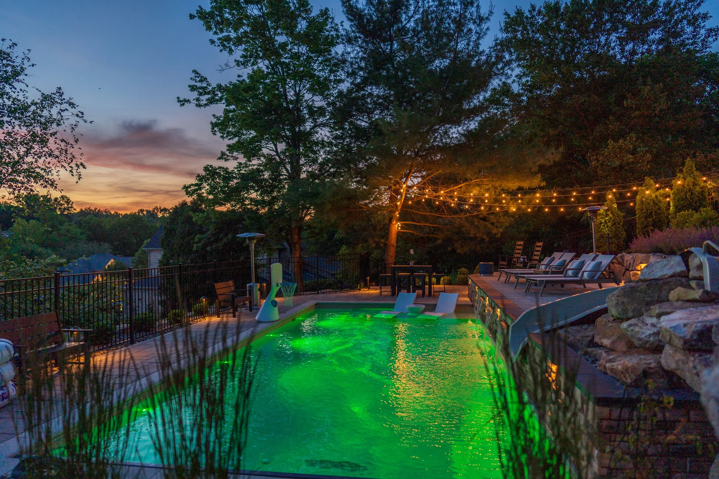
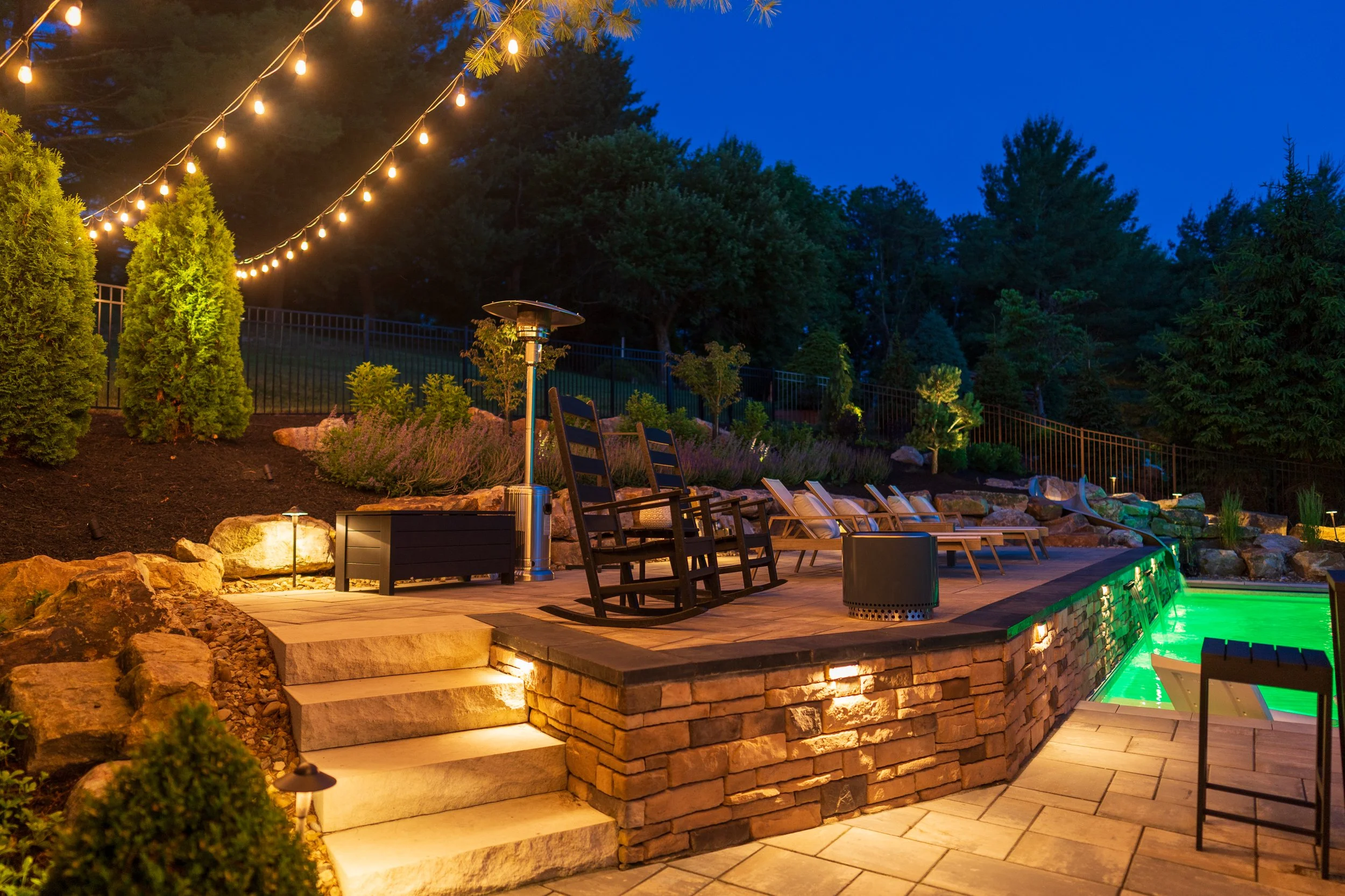
The boulder tiering. Sixty-six tons of boulders set as outcropping and tiering above and around the pool terrace, holding earth that would otherwise be somewhere else. In the finished photographs, the coping lights wash across their faces after dark, and the retention structure becomes the most sculptural element in the yard. That is the ideal outcome for structural work: it stops looking structural.
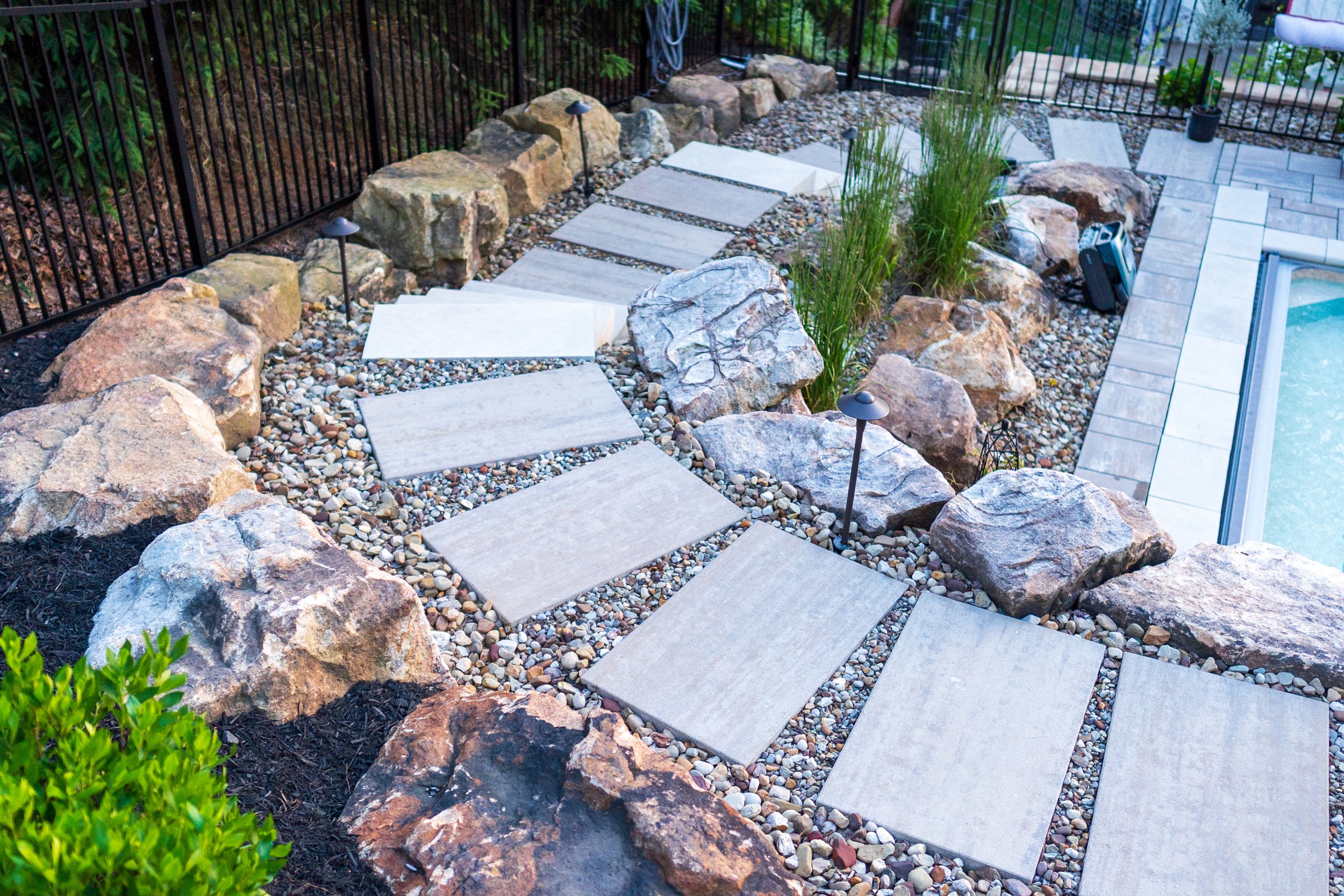
The stair and the patio. 943 square feet of multi-level paver patio, 71 square feet of extra-large stepping stone walkways, and twenty limestone Schenley steps, most of them forming a curving stair that descends through the boulder outcropping. The multi-level patio is not a style choice. It is what a patio becomes when the ground underneath it moves.
Challenges Encountered and Solutions Developed
Challenge: no level ground for a pool and patio. Solution: cut a terrace, retain it with a reinforced CMU wall below and boulder tiering above, and set the whole thing out from a measured site record so the elevations were known before excavation. Outcome: a level pool terrace that reads as native ground.
Challenge: water movement across a sloped work area. Solution: a drainage system designed alongside the structure rather than after it. Sixty-five feet of channel drain, a French drain at the pool, additional French drains through the boulder tiers, an eighty-foot swale carrying fifteen tons of river gravel, and a ten-by-ten drywell sump to terminate the system. Outcome: the terrace sheds water instead of collecting it.
Challenge: a shallow shelf that would not have worked as a tanning ledge. Solution: caught in 3D review and revised before construction, as described above. Outcome: a ledge with usable depth and permanent umbrella anchors.
Challenge: two specified materials became unavailable during the selection process. Solution: copper sheet-flow scuppers were replaced with black powder-coated units, and the limestone straight-edge coping on the feature wall was replaced with charcoal. Both substitutions were presented, documented, and signed off before installation. Outcome: no field improvisation, and a finished palette that holds together. On a project of this length, material availability moves. What matters is whether the substitution is a decision or a surprise.
TECHNOLOGY AND INNOVATION BY VIZYON DESIGN GROUP
Reality capture with the Trimble SX10 produced the site record. The design was developed in 3D against that record, which is where the tanning ledge revision was caught. Material quantities on complex grades, sixty-six tons of boulders, thirty-three tons of topsoil, the limestone and gravel volumes, come out of a model built on measured ground rather than out of an estimate.
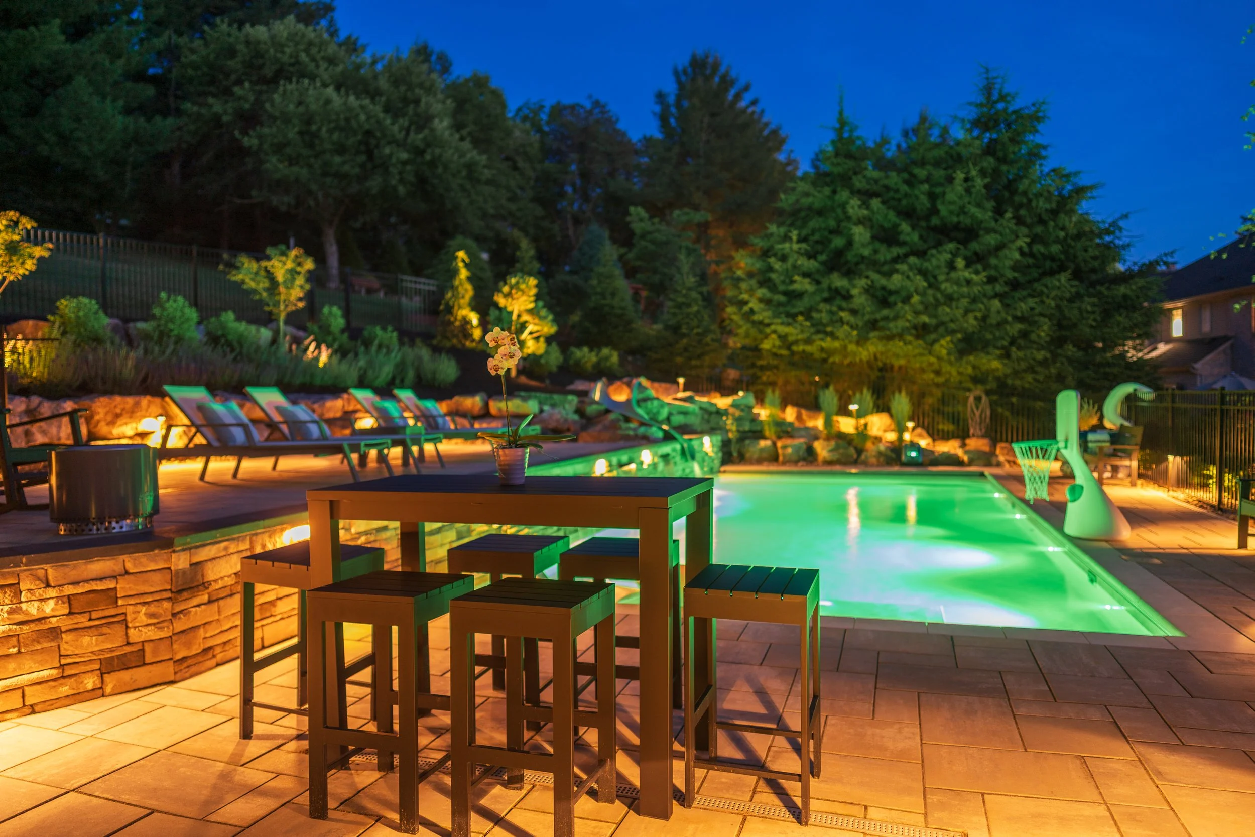
On the operating side, the finished environment runs on a single automation platform. A variable-speed circulation pump, a salt chlorine generator, a 250,000 BTU natural gas heater, color LED pool lighting, valve actuation for the water features, and thirty-four landscape light fixtures on scheduled control, all from one interface. That consolidation is worth naming because it is the difference between owning a pool and operating one.
The lighting deserves its own line. Eight accent lights, eighteen path lights, and eight coping lights, on transformer control. In daylight, the boulders are structure. After dark they are the feature. That was designed, not discovered.
WHY ACCURATE EXISTING CONDITIONS MATTER
This is the part worth reading if you are considering a project of your own, whether or not you ever call us.
Why perform LiDAR scanning on a residential property? Because the cost of being wrong about your site is paid during construction, and you pay it. On level ground, a tape measure and experience will usually get there. On ground that moves, the number of interdependent decisions rises sharply, and each one inherits the error in the one before it.
What is reality capture? A measured digital record of a property as it actually exists, captured before design begins. It is documentation, not decoration.
How accurate are point clouds? Survey-grade instruments produce records that are dramatically more precise than manual measurements, which is the relevant comparison for residential work.
Why does accurate documentation matter after the build? Because the record does not expire. Future phases, a renovation, a drainage question five years out, or a sale all become easier when the property is documented. The project is the asset you paid for. The record is the asset you keep.
How does site intelligence reduce risk? It moves discovery earlier. Every problem found in a model is cheap. The same problem found in the ground is a change order, a delay, and a conversation nobody enjoys. That is the entire argument, and it is why we scan before we design.
PROJECT OUTCOMES
Measurable Results
- A 16 x 36 foot pool, approximately 19,000 gallons, on a twelve-hour turnover
- 943 square feet of multi-level paver patio, plus 71 square feet of walkways
- A 58-foot raised bond beam and retaining wall carrying three scuppers
- Sixty-six tons of boulder tiering and outcropping
- A drainage system terminating in a ten-by-ten drywell sump
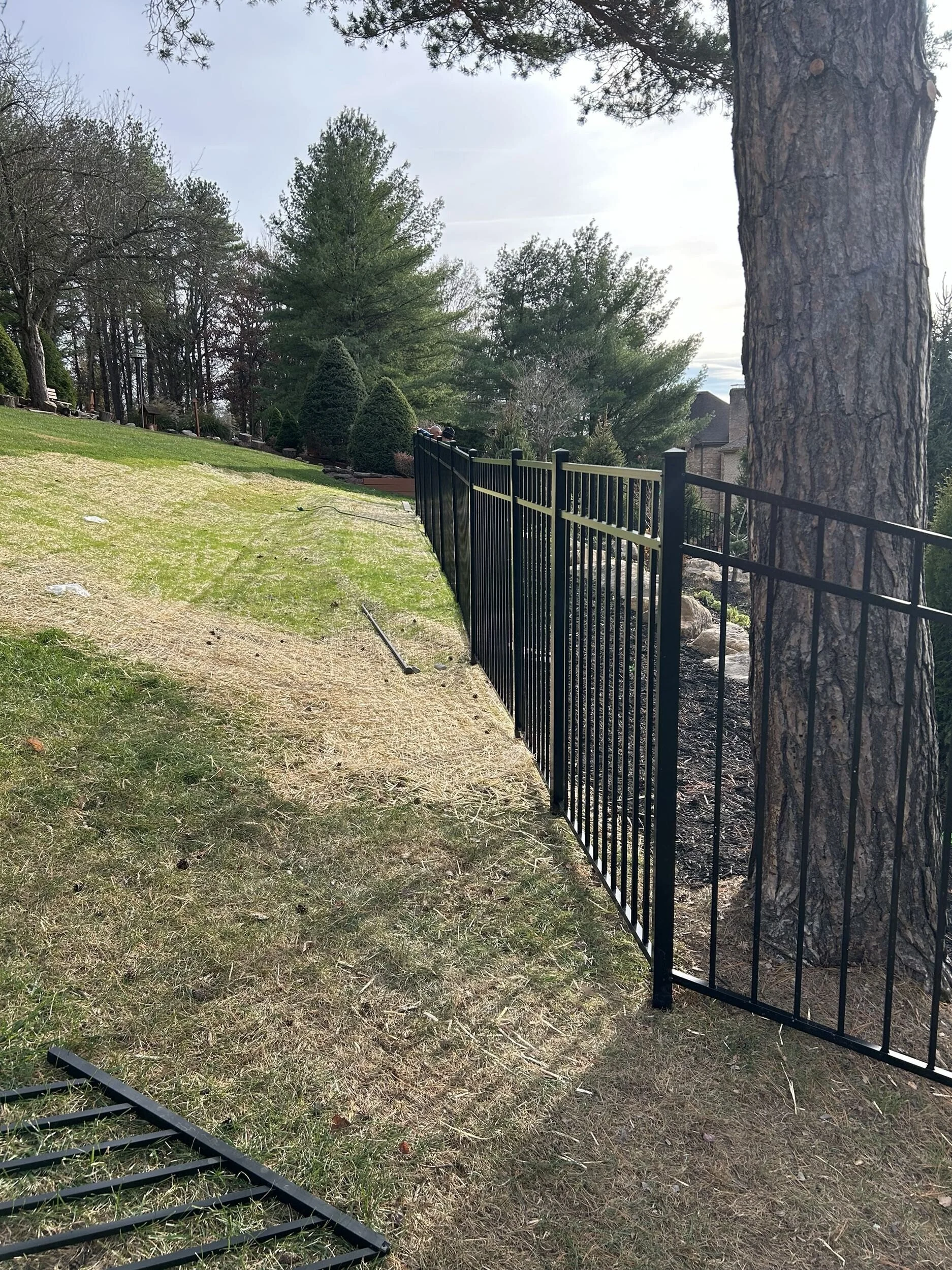
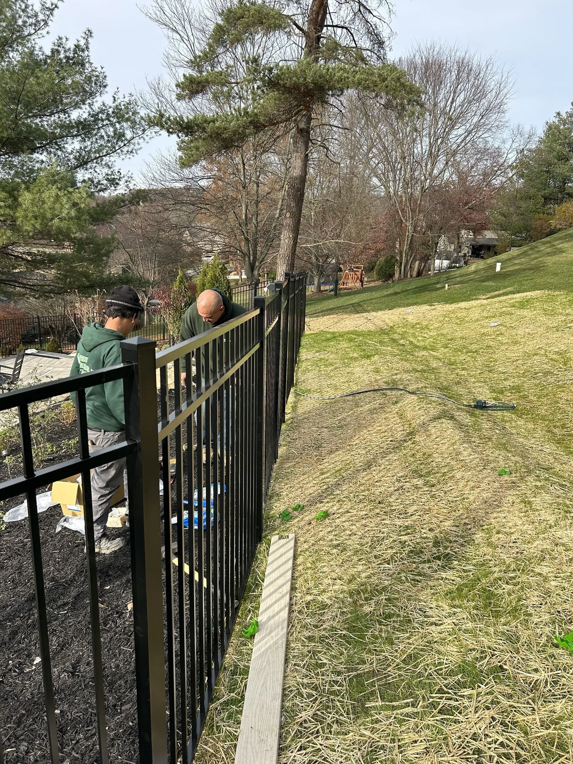
- 264 feet of self-closing, self-latching aluminum fence with three gates
- Thirty-four landscape light fixtures on scheduled automation
- Over two hundred individual plants and trees installed
- Approximately $380,000 investment
Client Benefits
- A level, usable outdoor living environment on a site that did not offer one
- Design decisions made and revised before construction, not during it
- Documented material substitutions rather than field improvisation
- Single-point accountability across five trade partners
- A measured record of the property that remains useful after completion
- Two-year hardscape workmanship warranty and one-year plant warranty, with thirty-six-month workmanship warranties held from every trade partner
Who built it.
PSW carried design, project management, and coordination in-house, with a defined team on every project: a Project Director, Project Designer, Project Administrator, Procurement Coordinator, and Project Manager. Specialist scopes went to five trade partners, each under direct agreement with PSW: Concrete Xpressions of Canonsburg on excavation, pool construction, the retaining structure, boulder setting, and drainage; Brigg's Electric of Bridgeville on plumbing and electrical utilities; Brickner Interlock of Bridgeville on the paver patio and coping; Penn Fencing of Butler on the aluminum fence; and Zito’s Landscaping of Glenshaw on the landscape and lighting installation. Every one of them carries a 36-month workmanship warranty to PSW, and PSW bears the responsibility to the homeowners throughout.
Looking Ahead
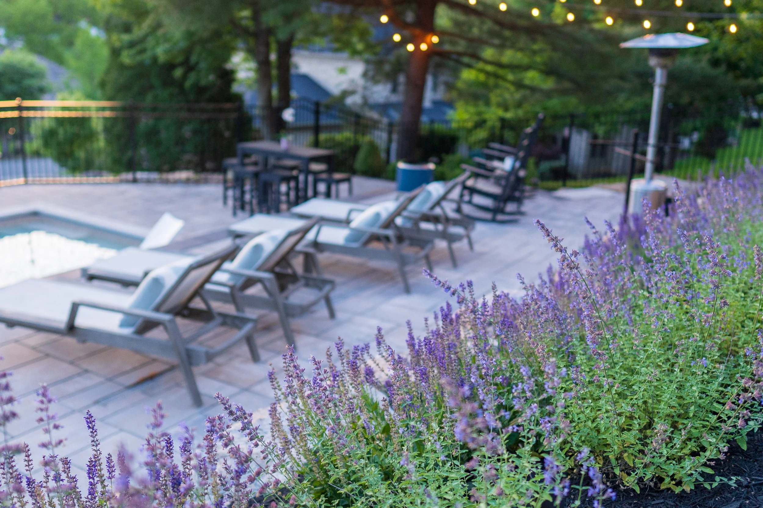
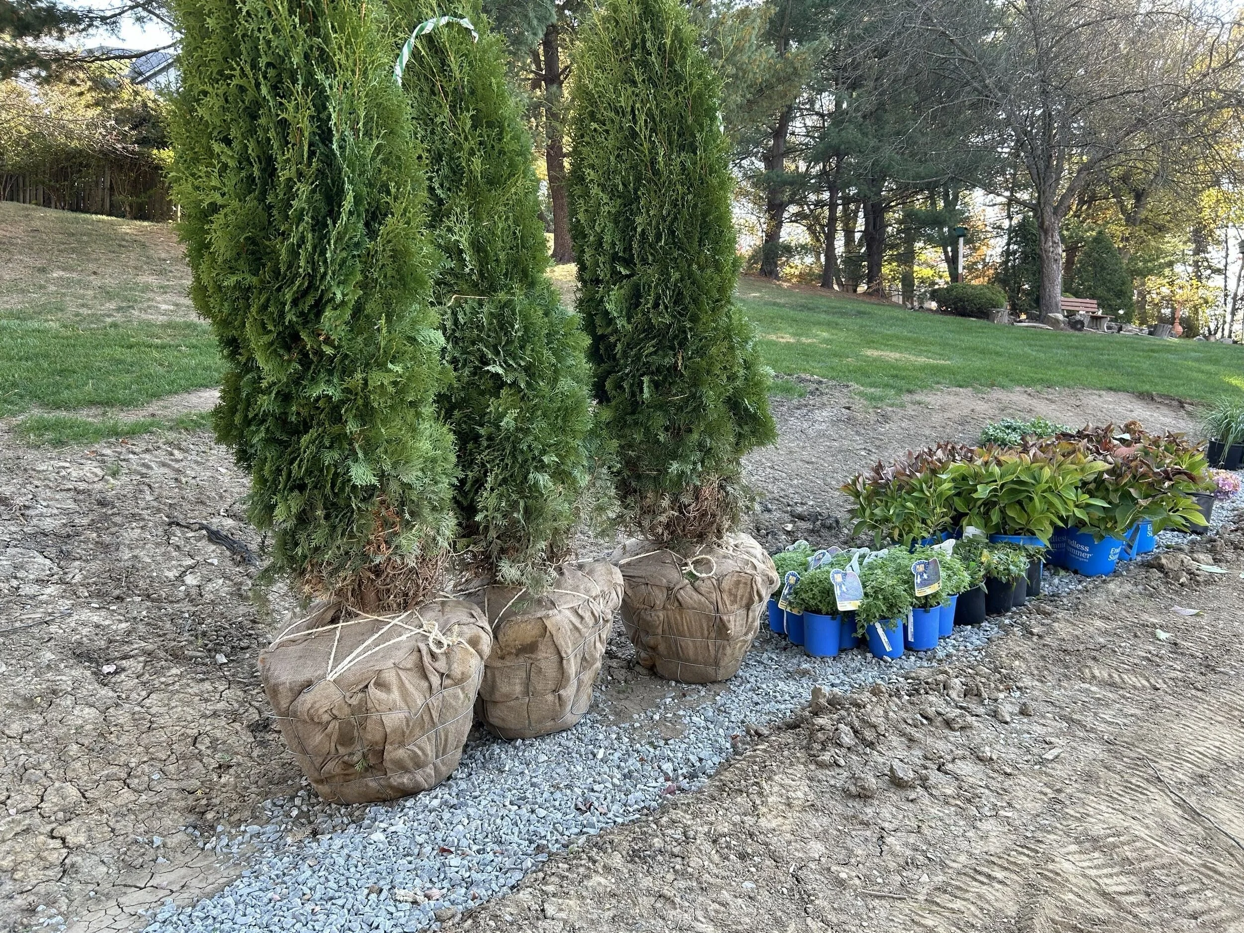
The plant palette here was chosen to mature. Arborvitae, Kousa dogwood, a cloud-form Scotch pine, hydrangea, clethra, catmint, and salvia through the foreground beds, ornamental grasses that carry structure into winter. The space photographed well in its first season. It will photograph better in its fifth, and better again in its tenth, which is the correct way to plan a permanent outdoor environment.
More broadly, this project is an example of where residential construction is going. Measured site records, design reviewed in three dimensions, documented selections, and consolidated automation are becoming the standard for work at this level rather than a differentiator. The reason is not that the technology is impressive. It is that it moves decisions earlier, and earlier decisions cost less.
CONCLUSION
This project began with a family who wanted a pool, a patio, and a slide, on ground that offered no level place to put any of them. What made it work was not a single clever move. It was a sequence: measure the site accurately, design against that measurement in three dimensions, catch the problems while they are still drawings, document every material decision, and hold accountability in one place while five specialist partners do their work.
The result is a level, lit, drained, planted outdoor living environment that looks like it was always meant to be there, on a property where nothing about it was inevitable.
If you are considering something like this, the question worth asking any builder is a simple one: how will you record my property before you design on it? The answer tells you most of what you need to know.
Related Services: Custom Pools and Spas, Outdoor Living Environments, Hardscape and Paver Patios, Retaining Structures, Drainage Design, Landscape Design and Installation, Landscape Lighting, Reality Capture, LiDAR Scanning, Existing Conditions Documentation, 3D Modeling
FREQUENTLY ASKED QUESTIONS
-
LiDAR uses pulsed laser light to measure distances precisely and repeatedly, building a three-dimensional record of a physical space. On a residential property, it captures grades, structures, walls, and plantings as they actually exist, producing a point cloud that design work is then built on top of.
-
Because outdoor projects are built on ground, and ground is rarely what people assume. Elevation changes, drainage behavior, and existing structures all constrain what can be built and where. Capturing that accurately before design means the design is feasible, not just attractive.
-
Survey-grade scanning is substantially more precise than manual measurement, which is the comparison that matters for residential construction. The practical effect is that the design and the finished build align.
-
Before design begins, capturing conditions after a concept has been developed means the concept may need to change, which is the expensive order of operations.
-
Sites with meaningful elevation change, projects with existing structures that have to meet, properties with drainage complexity, and any project where material quantities are difficult to estimate. This project had all four.
-
No. This site required a terrace, a retaining wall, and boulder tiering because of its grade. A flatter property needs far less. The honest answer is that you cannot know which category your property falls into until someone measures it, and that measurement is the least expensive part of the entire process.